| P number: | P001508 |
|---|---|
| Old photograph number: | D02111 |
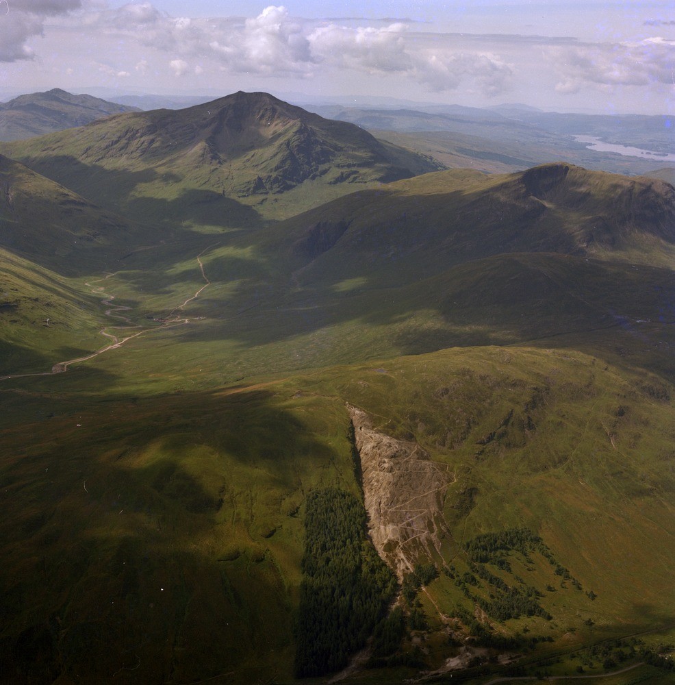
| Caption: | Oblique aerial view of the Tyndrum lead mine situated above the A82 road, Argyll, Strathclyde Region. |
| Description: | The mine worked two veins that vary from strings to 20 feet in thickness. The ore minerals are galena (lead ore) and zinc-blende, chalcopyrite and pyrites while the gangue or waste minerals that fill up most of the veins are massive white quartz with occasional patches of calcite and barytes. The veins were worked from the surface as shown by the gash and by ten levels. The Tyndrum veins were discovered in 1741 by Sir Robert Clifton of Clifton, a Nottinghamshire baronet who raised 1697 tons of lead ore between 1741 and 1745. Mining was almost continuous until 1862 when it became abandoned until 1916 when the Tyndrum Lead and Zinc Mines Ltd. erected plant to work the dumps and develop the mines. View looking south-west from above Tyndrum showing the workings of the lead and zinc mine in the foreground and crags of Dalradian mica-schist - Ben Lui, in background. |
| Date taken: | Thu Jan 01 00:00:00 GMT 1976 |
| Photographer: | Christie, A. |
| Copyright statement: | NERC |
| Acknowledgment: | This image was digitized with grant-in-aid from SCRAN the Scottish Cultural Resources Access Network |
| X longitude/easting: | 233000 |
| Y latitude/northing: | 730200 |
| Coordinate reference system, ESPG code: | 27700 (OSGB 1936 / British National Grid) |
| Orientation: | Portrait |
| Size: | 233.43 KB; 986 x 1000 pixels; 83 x 85 mm (print at 300 DPI); 261 x 265 mm (screen at 96 DPI); |
| Average Rating: | Not yet rated |
| Categories: | Unsorted Images |
Loading...
Loading...
Reviews
There is currently no feedback