| P number: | P219697 |
|---|---|
| Old photograph number: | D02791 |
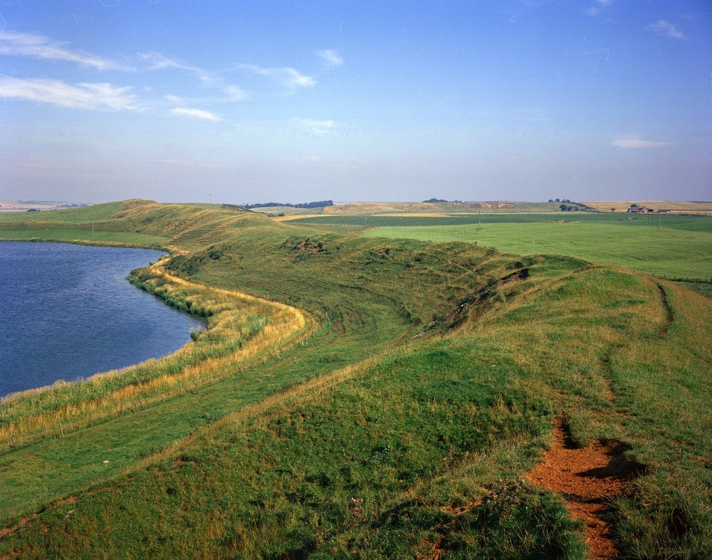
| Caption: | Kippet Hills. Looking N. |
| Description: | Kippet Hills. Looking N. Kippet Hills Esker, Slains. A sinuous ridge of sand and gravel joining up in the north with a kame terrace (in distance). Meikle Loch, a kettle lake, to the left. Low-lying boulder clay terrain to the right. The features are associated with the 'red-drift' of eastern Aberdeenshire. |
| Date taken: | Mon Jan 01 00:00:00 GMT 1979 |
| Photographer: | Christie, A. |
| Copyright statement: | NERC |
| X longitude/easting: | 403400 |
| Y latitude/northing: | 830700 |
| Coordinate reference system, ESPG code: | 27700 (OSGB 1936 / British National Grid) |
| Orientation: | Landscape |
| Size: | 295.37 KB; 1000 x 787 pixels; 85 x 67 mm (print at 300 DPI); 265 x 208 mm (screen at 96 DPI); |
| Average Rating: | Not yet rated |
| Categories: | Best of BGS Images/ Geological structures |
Loading...
Loading...
Reviews
There is currently no feedback