| P number: | P537143 |
|---|---|
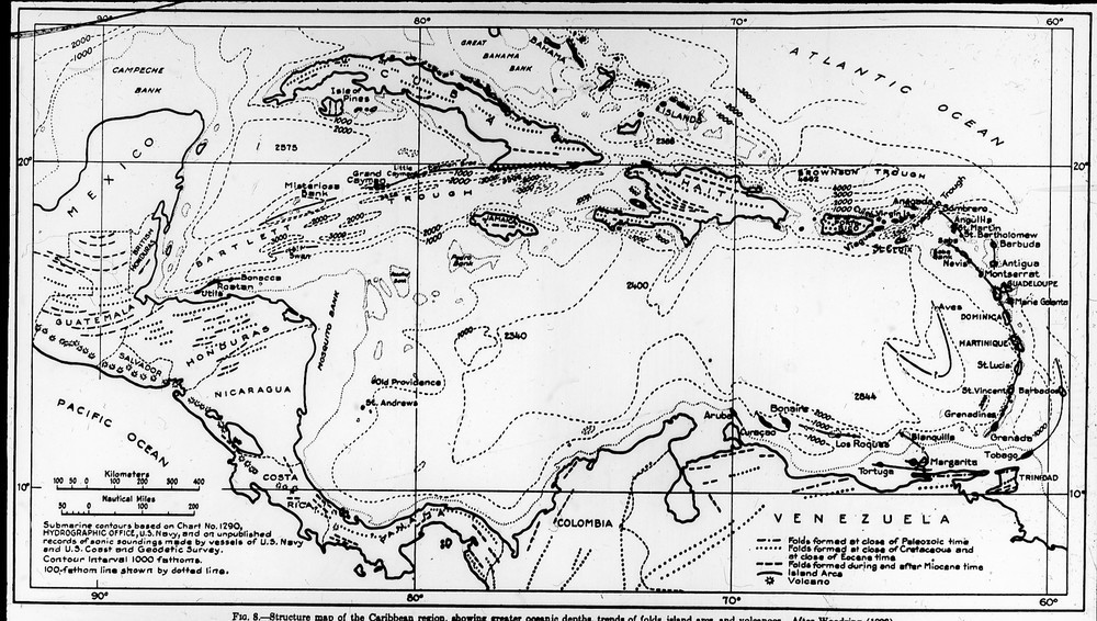
| Caption: | MN 2965. Map A Caribbean area. Structure map of the Caribbean region showing greater ocean depths, trends of folds, island arcs and volcanoes (after Woodring 1928. 1936 Royal Society Montserrat Expedition. |
| Date taken: | Wed Jan 01 00:00:00 GMT 1936 |
| Photographer: | Unknown |
| Copyright statement: | NERC |
| Additional information: | The Archibald Gordon MacGregor Archive. In 1936 the Royal Society in collaboration with the Colonial Office organized an expedition to Montserrat to study the geology and investigate the earthquakes and soufrière activity that had caused damage in the previous two years. The personnel on the expedition were Dr C F Powell and Dr A G MacGregor. |
| Orientation: | Landscape |
| Size: | 227.92 KB; 1000 x 566 pixels; 85 x 48 mm (print at 300 DPI); 265 x 150 mm (screen at 96 DPI); |
| Average Rating: | Not yet rated |
| Categories: | Special collections/ 1936 Royal Society expedition to Montserrat - The A.G. MacGregor archive |
Loading...
Loading...
Reviews
There is currently no feedback