| P number: | P001441 |
|---|---|
| Old photograph number: | Z00022 |
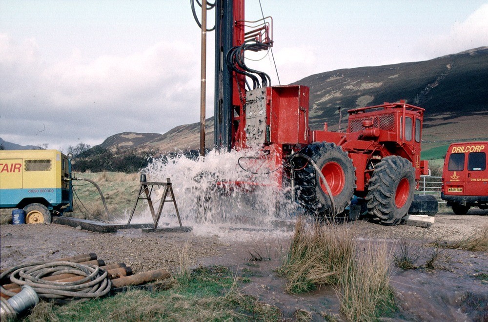
| Caption: | Bridge Farm borehole, Machrie, Arran. Drilling a groundwater production borehole for West of Scotland Water at Machrie, Arran. |
| Description: | The drill rig is located close to the 'String' road from Brodick at a site chosen by the Hydrogeology Group of BGS. The rig is using an air flush hammer to drill through Permian sandstone. The compressor is seen at the left. Compressed air is sent down the drill rods to the hammer at the bottom of the borehole. The air operates the hammer and brings cuttings and water to the surface. The water flows away from the site to a stream. The 4-wheel drive tractor unit powers the rig and is highly manoeuvrable - useful for sites with problematical access. |
| Date taken: | Thu Jan 01 00:00:00 GMT 1998 |
| Photographer: | Ball, D.F. |
| Copyright statement: | NERC |
| X longitude/easting: | 192680 |
| Y latitude/northing: | 631910 |
| Coordinate reference system, ESPG code: | 27700 (OSGB 1936 / British National Grid) |
| Orientation: | Landscape |
| Size: | 251.85 KB; 1000 x 660 pixels; 85 x 56 mm (print at 300 DPI); 265 x 175 mm (screen at 96 DPI); |
| Average Rating: | Not yet rated |
| Categories: | Best of BGS Images/ Industrial geology |
Loading...
Loading...
Reviews
There is currently no feedback