| P number: | P218993 |
|---|---|
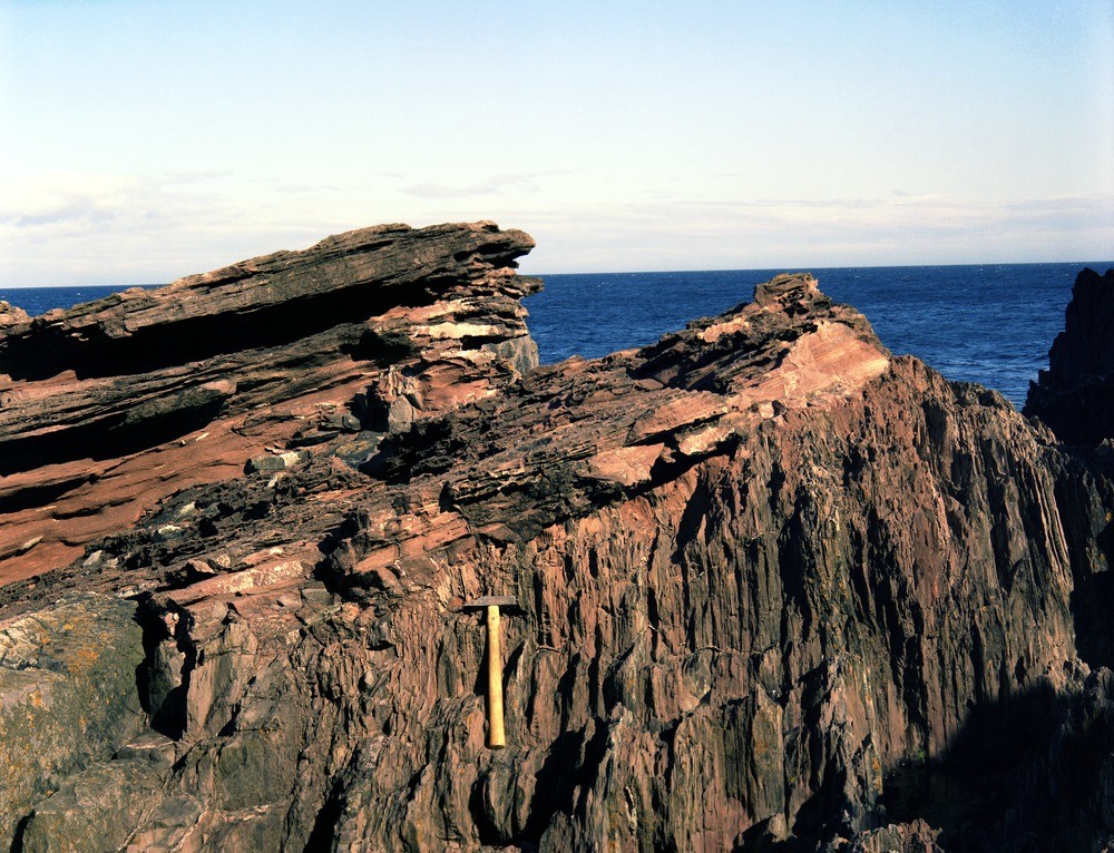
| Old photograph number: | D01471 |
| Caption: | Siccar Point, 4 km. E. of Cockburnspath. |
| Description: | Siccar Point, 4 km. E. of Cockburnspath. Unconformable junction of Upper Old Red Sandstone on vertical Silurian rocks. |
| Date taken: | Thu Jan 01 00:00:00 GMT 1976 |
| Photographer: | Christie, A. |
| Copyright statement: | NERC |
| X longitude/easting: | 381260 |
| Y latitude/northing: | 670940 |
| Coordinate reference system, ESPG code: | 27700 (OSGB 1936 / British National Grid) |
| Orientation: | Landscape |
| Size: | 321.35 KB; 1000 x 766 pixels; 85 x 65 mm (print at 300 DPI); 265 x 203 mm (screen at 96 DPI); |
| Average Rating: | Not yet rated |
| Categories: | Best of BGS Images/ Geological structures, Geoscience subjects/ Structural features/ Unconformities and junction planes between beds of different age, Geoscience subjects/ Named locality |
Loading...
Loading...
Reviews
There is currently no feedback