| P number: | P218440 |
|---|---|
| Old photograph number: | D00841 |
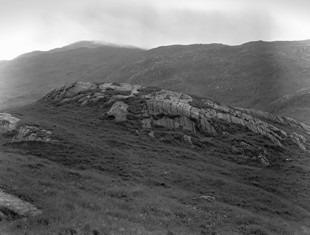
| Caption: | Roche moutonnee with glacial striae, Kinlochhourn-Quoich watershed, Invernessshire. |
| Description: | Ice movement is from right to left. The roche moutonnee which has formed by the occurrence of small crags projecting into the path of a glacier. It becomes streamlined, or ice-moulded with the upstream end rounded off and the lee side is made steep by the plucking action of the ice on unsupported blocks. This can be helped when the rock contains vertical joints. In plan the roche moutonnee's outline is a truncated oval. They provide evidence of the direction of movement of the ice. Also indicating direction of ice movement are the glacial striae. Glacial striae are formed because the glacier bottom has frozen-in blocks of rock debris of all sizes. These act as abrasives and scratch and polish the underlying rock floor. Hard rocks retain glacia striae while softer rocks usually lose them through subsequent weathering. |
| Date taken: | Sun Jan 01 00:00:00 GMT 1967 |
| Photographer: | Christie, A. |
| Copyright statement: | NERC |
| X longitude/easting: | 197300 |
| Y latitude/northing: | 804600 |
| Coordinate reference system, ESPG code: | 27700 (OSGB 1936 / British National Grid) |
| Orientation: | Landscape |
| Size: | 218.60 KB; 1001 x 757 pixels; 85 x 64 mm (print at 300 DPI); 265 x 200 mm (screen at 96 DPI); |
| Average Rating: | Not yet rated |
| Categories: | Unsorted Images, Geoscience subjects/ Landforms, glaciation/ Roche mountonne |
Loading...
Loading...
Reviews
There is currently no feedback