| P number: | P218389 |
|---|---|
| Old photograph number: | D00782 |
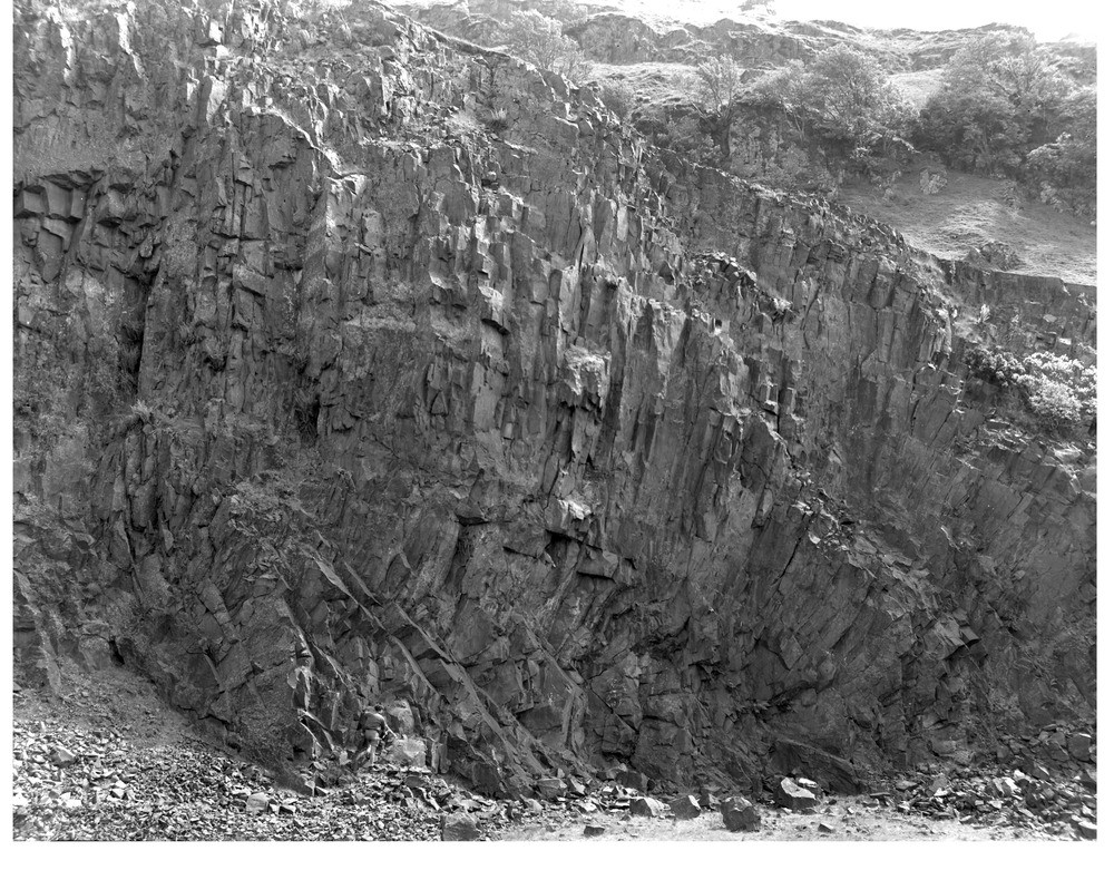
| Caption: | The composite basaltic sill known as the Dounie's Loup Sill, exposed in Dinning Quarry. |
| Description: | The composite basaltic sill known as the Dounie's Loup Sill, exposed in Dinning Quarry. This sill is intruded into Calciferous Sandstone Measures sediments immediately below the lava escarpment of the Gargunnock Hills. The radial arrangement of vertical joints reflects in horizon down to the west (on the right of the photograph). |
| Date taken: | Mon Jan 01 00:00:00 GMT 1962 |
| Photographer: | Fisher, W.D. |
| Copyright statement: | Crown |
| X longitude/easting: | 270500 |
| Y latitude/northing: | 693500 |
| Coordinate reference system, ESPG code: | 27700 (OSGB 1936 / British National Grid) |
| Orientation: | Landscape |
| Size: | 348.59 KB; 1000 x 790 pixels; 85 x 67 mm (print at 300 DPI); 265 x 209 mm (screen at 96 DPI); |
| Average Rating: | Not yet rated |
| Categories: | Unsorted Images |
Loading...
Loading...
Reviews
There is currently no feedback