| P number: | P218010 |
|---|---|
| Old photograph number: | D00345 |
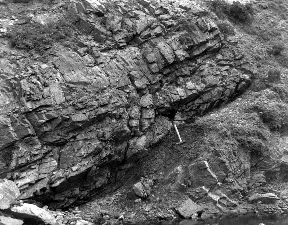
| Caption: | Burn of Valayre, 2.4 km. NNE of Brae. |
| Description: | Burn of Valayre, 2.4 km. NNE of Brae. Thrust plane; the sheared rock is easily recognized as such. |
| Date taken: | Sun Jan 01 00:00:00 GMT 1961 |
| Photographer: | Fisher, W.D. |
| Copyright statement: | Crown |
| X longitude/easting: | 437500 |
| Y latitude/northing: | 1169500 |
| Coordinate reference system, ESPG code: | 27700 (OSGB 1936 / British National Grid) |
| Orientation: | Landscape |
| Size: | 351.43 KB; 1001 x 781 pixels; 85 x 66 mm (print at 300 DPI); 265 x 207 mm (screen at 96 DPI); |
| Average Rating: | Not yet rated |
| Categories: | Unsorted Images, Geoscience subjects/ Structural features/ Thrusting |
Loading...
Loading...
Reviews
There is currently no feedback