| P number: | P001298 |
|---|---|
| Old photograph number: | D05512 |
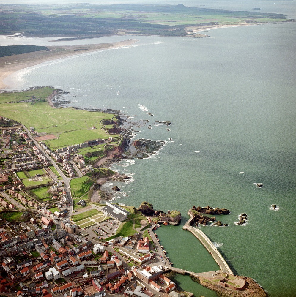
| Caption: | Oblique aerial view of Dunbar and the Tyne estuary, looking from the east. |
| Description: | The Battery to the right of the harbour is a basanite intrusion with columns; Dunbar Castle and harbour entrance sit on vent agglomerate and basanite intrusion (a volcanic plug) with hexagonal columnar joints; West Bay is composed of red sandstones and a large vent agglomerate crossed by dykes/joints and bedded cementstone strata; St. Margaret's is formed of bedded cementstone strata. The Tyne estuary is in the middle distance with a large hooked spit on the south side and another spit formed on the north side within the estuary (Sandy Hirst). In the far distance, East Lothian coastal plain with Lower Carboniferous volcanic plugs of North Berwick Law and Bass Rock. The town is built on flattish ground of glacial and raised beach deposits. The Lower Carboniferous sedimentary and igneous rocks are exposed in cliffs and on the intertidal foreshore. |
| Date taken: | Wed May 01 00:00:00 BST 1996 |
| Photographer: | Bain, T.S. |
| Copyright statement: | NERC |
| Acknowledgment: | This image was digitized with grant-in-aid from SCRAN the Scottish Cultural Resources Access Network |
| X longitude/easting: | 366500 |
| Y latitude/northing: | 679000 |
| Coordinate reference system, ESPG code: | 27700 (OSGB 1936 / British National Grid) |
| Orientation: | Portrait |
| Size: | 385.36 KB; 996 x 1000 pixels; 84 x 85 mm (print at 300 DPI); 264 x 265 mm (screen at 96 DPI); |
| Average Rating: | Not yet rated |
| Categories: | Best of BGS Images/ Landscapes |
Loading...
Loading...
Reviews
There is currently no feedback