| P number: | P001291 |
|---|---|
| Old photograph number: | D05502 |
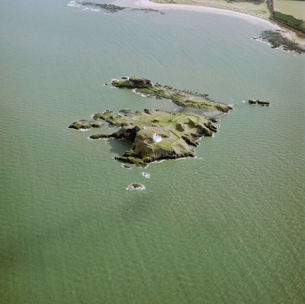
| Caption: | Oblique aerial view of the island of Fidra, looking from the north-north-west. East Lothian. |
| Description: | Nodules of peridotite and pyroxenite are a feature of the rock, xenoliths of sedimentary rocks also occur. The two parts of the island are joined by a shingle storm beach. Longskelly Point, top centre is formed of a similar basalt sill. Longskelly Rocks, top right are formed of Markle Basalt lavas. The intrusion is related to the Carboniferous Dinantian age Garleton Hills Volcanic Rocks. An island formed of a Lower Carboniferous olivine-basalt sill. It is a flat-lying sill with vertical, columnar dolerite cut by horizontal joints in the cliffs and skerries. The white building is the lighthouse. |
| Date taken: | Wed May 01 00:00:00 BST 1996 |
| Photographer: | Bain, T.S. |
| Copyright statement: | NERC |
| Acknowledgment: | This image was digitized with grant-in-aid from SCRAN the Scottish Cultural Resources Access Network |
| X longitude/easting: | 351000 |
| Y latitude/northing: | 686500 |
| Coordinate reference system, ESPG code: | 27700 (OSGB 1936 / British National Grid) |
| Orientation: | Landscape |
| Size: | 319.64 KB; 1000 x 998 pixels; 85 x 84 mm (print at 300 DPI); 265 x 264 mm (screen at 96 DPI); |
| Average Rating: | Not yet rated |
| Categories: | Best of BGS Images/ Landscapes |
Loading...
Loading...
Reviews
There is currently no feedback