| P number: | P001247 |
|---|---|
| Old photograph number: | D05447 |
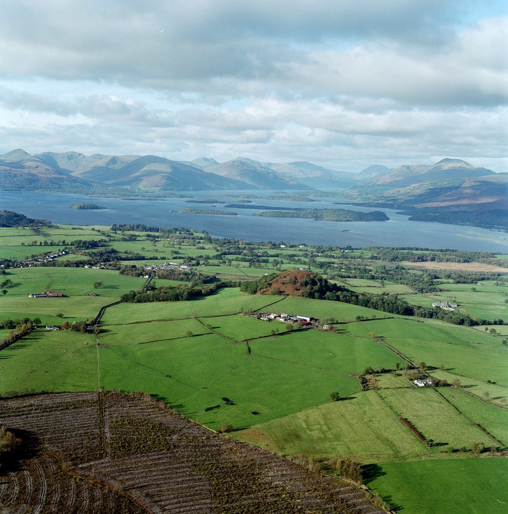
| Caption: | Oblique aerial view north-west of Gartocharn to Loch Lomond and Ben Lomond and the Duncryne plug. |
| Description: | Around Luss (upper left) slate quarries are seen - in the Dunoon Phyllites (Dalradian) that here lie in the core of a large recumbent fold that forms part of a large nappe-like structure. This 'Tay Nappe' is downbent near to the Highland Border. The islands in Loch Lomond initially mark the Highland Border and then include downfaulted Upper Devonian/Lower Carboniferous sandstones and conglomerates, and finally are composed of Dalradian cleaved greywackes. The latter is a small Lower Carboniferous volcanic plug that makes an admirable viewpoint of Loch Lomond. The surrounding low ground is Quaternary till and sands and gravels. |
| Date taken: | Fri Nov 01 00:00:00 GMT 1996 |
| Photographer: | MacTaggart, F.I. |
| Copyright statement: | NERC |
| Acknowledgment: | This image was digitized with grant-in-aid from SCRAN the Scottish Cultural Resources Access Network |
| X longitude/easting: | 243500 |
| Y latitude/northing: | 685900 |
| Coordinate reference system, ESPG code: | 27700 (OSGB 1936 / British National Grid) |
| Orientation: | Portrait |
| Size: | 333.64 KB; 988 x 1000 pixels; 84 x 85 mm (print at 300 DPI); 261 x 265 mm (screen at 96 DPI); |
| Average Rating: | Not yet rated |
| Categories: | Best of BGS Images/ Landscapes |
Loading...
Loading...
Reviews
There is currently no feedback