| P number: | P001245 |
|---|---|
| Old photograph number: | D05445 |
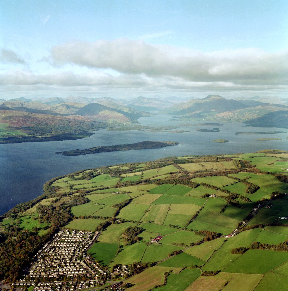
| Caption: | Oblique aerial view north-north-west from Balloch to Loch Lomond and the Arrochar and Luss Hills. Looking up the central line of Loch Lomond from its island-studded lower shallow part to its deeper ice-scoured trench farther north. |
| Description: | Oblique aerial view north-north-west from Balloch to Loch Lomond and the Arrochar and Luss Hills. Looking up the central line of Loch Lomond from its island-studded lower shallow part to its deeper ice-scoured trench farther north. The agricultural ground consists of till and sand and gravel in part formed in front of the Loch Lomond Readvance with deposits also laid down following the Late Devonian glacial episode. Inchmurrin is the prominent island that lies furthest south. It consists of Lower Devonian conglomerate on its south-east side, Highland Border rocks, and Upper Devonian/Lower Carboniferous sandstones on its north-west side. The islands farther north are either the Devonian/Carboniferous sandstones or the Dalradian greywackes that form almost all the high ground. |
| Date taken: | Fri Nov 01 00:00:00 GMT 1996 |
| Photographer: | MacTaggart, F.I. |
| Copyright statement: | NERC |
| Acknowledgment: | This image was digitized with grant-in-aid from SCRAN the Scottish Cultural Resources Access Network |
| X longitude/easting: | 239000 |
| Y latitude/northing: | 686000 |
| Coordinate reference system, ESPG code: | 27700 (OSGB 1936 / British National Grid) |
| Orientation: | Portrait |
| Size: | 288.59 KB; 989 x 1000 pixels; 84 x 85 mm (print at 300 DPI); 262 x 265 mm (screen at 96 DPI); |
| Average Rating: | Not yet rated |
| Categories: | Best of BGS Images/ Landscapes |
Loading...
Loading...
Reviews
There is currently no feedback