| P number: | P001244 |
|---|---|
| Old photograph number: | D05444 |
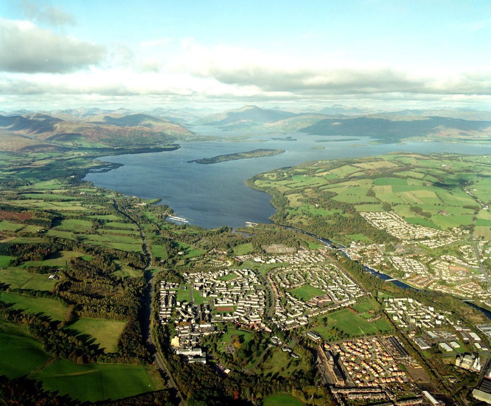
| Caption: | View north from Balloch to Loch Lomond and River Leven. The height of this river outlet was raised during the Loch Lomond Readvance when marine clays and silts and later sands and gravels were deposited before the ice reached its maximum extent. |
| Description: | View north from Balloch to Loch Lomond and River Leven. The height of this river outlet was raised during the Loch Lomond Readvance when marine clays and silts and later sands and gravels were deposited before the ice reached its maximum extent. The Highland Line is defined by the line of islands that lie farthest south-east (Inchmurrin - Creinch - Torrinch - Inchcailloch). The low ground of the Rossdhu peninsula (left) is underlain by Upper Devonian/Lower Carboniferous sandstones and conglomerates. |
| Date taken: | Fri Nov 01 00:00:00 GMT 1996 |
| Photographer: | MacTaggart, F.I. |
| Copyright statement: | NERC |
| Acknowledgment: | This image was digitized with grant-in-aid from SCRAN the Scottish Cultural Resources Access Network |
| X longitude/easting: | 238000 |
| Y latitude/northing: | 682000 |
| Coordinate reference system, ESPG code: | 27700 (OSGB 1936 / British National Grid) |
| Orientation: | Landscape |
| Size: | 315.19 KB; 1000 x 827 pixels; 85 x 70 mm (print at 300 DPI); 265 x 219 mm (screen at 96 DPI); |
| Average Rating: | Not yet rated |
| Categories: | Best of BGS Images/ Landscapes |
Loading...
Loading...
Reviews
There is currently no feedback