| P number: | P001225 |
|---|---|
| Old photograph number: | D05406 |
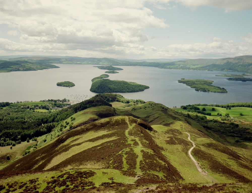
| Caption: | View to south-west from Conic Hill, of Balmaha, Loch Lomond and the islands of Inchcailloch, Torrinch, Creinch and Inchmurrin. |
| Description: | The dry valley to the north-west (right) contains the Gualann Fault with the subsidiary grassy ridge consisting mainly of serpentinite - now largely brecciated and altered to dolomite. Its derived clastic origin is seen in parts. The low relief areas to the north-west (right) and Inchfad are underlain by Upper Devonian - Lower Carboniferous sandstones of the Kinnesswood Formation. The line of the Highland Border is clearly seen by the alignment of islands across Loch Lomond. Looking along the Highland Boundary from Conic Hill to the south-west. The main ridge is formed of steeply south-east dipping Lower Devonian Inchmurrin Conglomerate. |
| Date taken: | Sat Jul 01 00:00:00 BST 1995 |
| Photographer: | MacTaggart, F.I. |
| Copyright statement: | NERC |
| Acknowledgment: | This image was digitized with grant-in-aid from SCRAN the Scottish Cultural Resources Access Network |
| X longitude/easting: | 243000 |
| Y latitude/northing: | 692200 |
| Coordinate reference system, ESPG code: | 27700 (OSGB 1936 / British National Grid) |
| Orientation: | Landscape |
| Size: | 236.38 KB; 1000 x 769 pixels; 85 x 65 mm (print at 300 DPI); 265 x 203 mm (screen at 96 DPI); |
| Average Rating: | Not yet rated |
| Categories: | Best of BGS Images/ Landscapes |
Loading...
Loading...
Reviews
There is currently no feedback