| P number: | P001219 |
|---|---|
| Old photograph number: | D05397 |
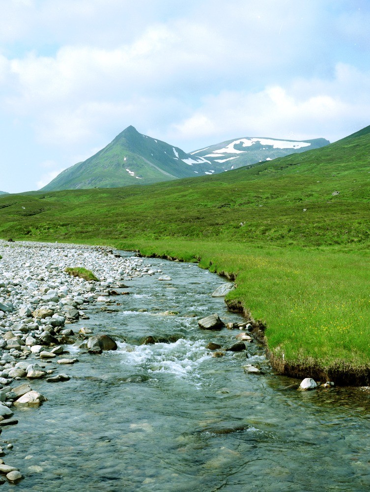
| Caption: | Looking west-south-west from the Allt a' Chaoil-reidhe by Culra Bothy. Inverness-shire. |
| Description: | The col between Sgor Iutharn and Geal Charn marks the first slide in tightly folded, locally migmatitic psammites and minor semipelites. Further slide zones and folding occur on the slopes of Geal Charn. They lie within the Kinlochlaggan Steep Belt. Sgor Iutharn and Geal Charn enclose a large corrie, Coire Sgoir. They are formed mainly of steeply-inclined Grampian Group psammites that young mainly to the south-east (left) on Sgor Iutharn (Lancet Edge). |
| Date taken: | Sat Jul 01 00:00:00 BST 1995 |
| Photographer: | MacTaggart, F.I. |
| Copyright statement: | NERC |
| Acknowledgment: | This image was digitized with grant-in-aid from SCRAN the Scottish Cultural Resources Access Network |
| X longitude/easting: | 252300 |
| Y latitude/northing: | 776000 |
| Coordinate reference system, ESPG code: | 27700 (OSGB 1936 / British National Grid) |
| Orientation: | Portrait |
| Size: | 268.69 KB; 753 x 1001 pixels; 64 x 85 mm (print at 300 DPI); 199 x 265 mm (screen at 96 DPI); |
| Average Rating: | Not yet rated |
| Categories: | Best of BGS Images/ Landscapes |
Loading...
Loading...
Reviews
There is currently no feedback