| P number: | P001161 |
|---|---|
| Old photograph number: | D04489 |
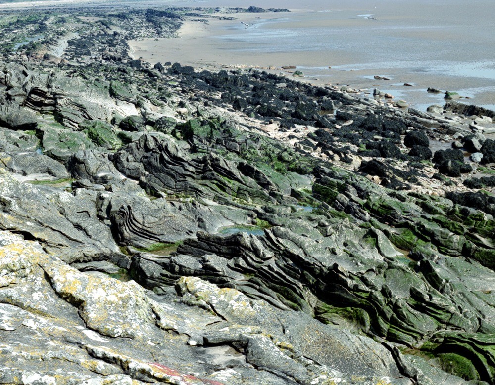
| Caption: | Taken from about 100 m. north of the Thirl Stane natural arch, Powillimount, looking north-north-east. Thirlstane Sandstone Member of the Powillimount Sandstone Formation, Carboniferous. |
| Description: | Taken from about 100 m. north of the Thirl Stane natural arch, Powillimount, looking north-north-east. Thirlstane Sandstone Member of the Powillimount Sandstone Formation, Carboniferous. Allokinetic liquefaction structures consisting of domes and volcanoes, bedding deformation increasing towards the north end of the outcrop (beyond the geologist). Strata of the Arbigland Limestone Formation occupy the background and are faulted against the Thirlstane Sandstone. Liquefaction is the transformation of loose sediment into a fluid mass preliminary to movement e.g. in a turbidity current or subaqueous slumping or sliding. |
| Date taken: | Tue May 01 00:00:00 BST 1990 |
| Photographer: | McTaggart, F.I. |
| Copyright statement: | NERC |
| Acknowledgment: | This image was digitized with grant-in-aid from SCRAN the Scottish Cultural Resources Access Network |
| X longitude/easting: | 299250 |
| Y latitude/northing: | 556840 |
| Coordinate reference system, ESPG code: | 27700 (OSGB 1936 / British National Grid) |
| Orientation: | Landscape |
| Size: | 383.40 KB; 1000 x 779 pixels; 85 x 66 mm (print at 300 DPI); 265 x 206 mm (screen at 96 DPI); |
| Average Rating: | Not yet rated |
| Categories: | Unsorted Images |
Loading...
Loading...
Reviews
There is currently no feedback