| P number: | P001154 |
|---|---|
| Old photograph number: | D04192 |
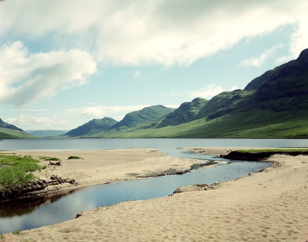
| Caption: | View north-east along Lochan na h-Earba, south of Loch Laggan, Inverness-shire. |
| Description: | Both formations form part of the Grampian Group, (Dalradian Supergroup). They are cut by numerous pegmatite sheets associated with the Loch Laggan Vein Complex. The smooth slopes near to the bottom of the valley are underlain by till whereas the sandy beach is derived from an alluvial fan. The valley is controlled by the Markie Fault. The mountainsides are underlain mostly by the Loch Laggan Psammite Formation, a succession of medium to thick bedded turbiditic metasandstones. These are overlain by the Ardair Semipelite Formation, representing originally muddier turbiditic sediments, visible on the higher parts of the slopes in the middle and near distance. |
| Date taken: | Sat Jul 01 00:00:00 BST 1989 |
| Photographer: | Bain, T.S. |
| Copyright statement: | NERC |
| Acknowledgment: | This image was digitized with grant-in-aid from SCRAN the Scottish Cultural Resources Access Network |
| X longitude/easting: | 246300 |
| Y latitude/northing: | 781300 |
| Coordinate reference system, ESPG code: | 27700 (OSGB 1936 / British National Grid) |
| Orientation: | Landscape |
| Size: | 198.65 KB; 1001 x 787 pixels; 85 x 67 mm (print at 300 DPI); 265 x 208 mm (screen at 96 DPI); |
| Average Rating: | Not yet rated |
| Categories: | Unsorted Images |
Loading...
Loading...
Reviews
There is currently no feedback