| P number: | P216162 |
|---|---|
| Old photograph number: | C02102 |
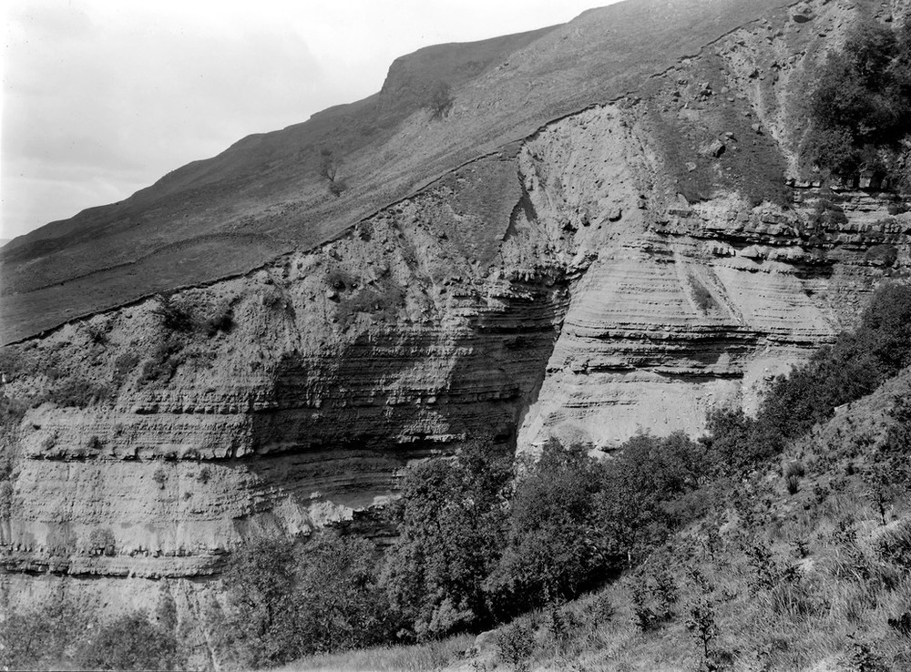
| Caption: | Ballagan Burn 1.3 km. E. of Strathblane. |
| Description: | Ballagan Burn 1.3 km. E. of Strathblane. Type section of Ballagan Beds. Alternating bands of mudstone and cementstone belonging to the Cementstone Group of Lower Carboniferous age, capped by deep boulder clay. Escarpment of overlying lava flows of the Campsie volcanic plateau seen on skyline. |
| Date taken: | Wed Jan 01 00:00:00 GMT 1913 |
| Photographer: | Lunn, R. |
| Copyright statement: | Crown |
| X longitude/easting: | 257500 |
| Y latitude/northing: | 679500 |
| Coordinate reference system, ESPG code: | 27700 (OSGB 1936 / British National Grid) |
| Orientation: | Landscape |
| Size: | 292.41 KB; 1000 x 738 pixels; 85 x 62 mm (print at 300 DPI); 265 x 195 mm (screen at 96 DPI); |
| Average Rating: | Not yet rated |
| Categories: | Unsorted Images, Geoscience subjects/ Stratigraphical |
Loading...
Loading...
Reviews
There is currently no feedback