| P number: | P216128 |
|---|---|
| Old photograph number: | C02048 |
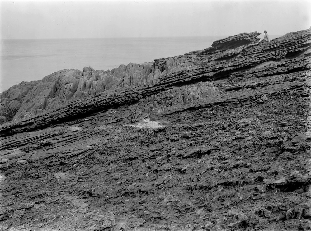
| Caption: | Siccar Point, 4.0 km. E. of Cockburnspath. |
| Description: | Siccar Point, 4.0 km. E. of Cockburnspath. Unconformable junction of Upper Old Red Sandstone (A), on Silurian (B). The vertical Silurian rocks are seen protruding through the Upper Old Red Sandstone beds. |
| Date taken: | Thu Jan 01 00:00:00 GMT 1914 |
| Photographer: | Lunn, R. |
| Copyright statement: | Crown |
| X longitude/easting: | 381500 |
| Y latitude/northing: | 670500 |
| Coordinate reference system, ESPG code: | 27700 (OSGB 1936 / British National Grid) |
| Orientation: | Landscape |
| Size: | 264.38 KB; 999 x 743 pixels; 85 x 63 mm (print at 300 DPI); 264 x 197 mm (screen at 96 DPI); |
| Average Rating: | Not yet rated |
| Categories: | Unsorted Images, Geoscience subjects/ Stratigraphical, Geoscience subjects/ Structural features/ Unconformities and junction planes between beds of different age |
Loading...
Loading...
Reviews
There is currently no feedback