| P number: | P216119 |
|---|---|
| Old photograph number: | C02037 |
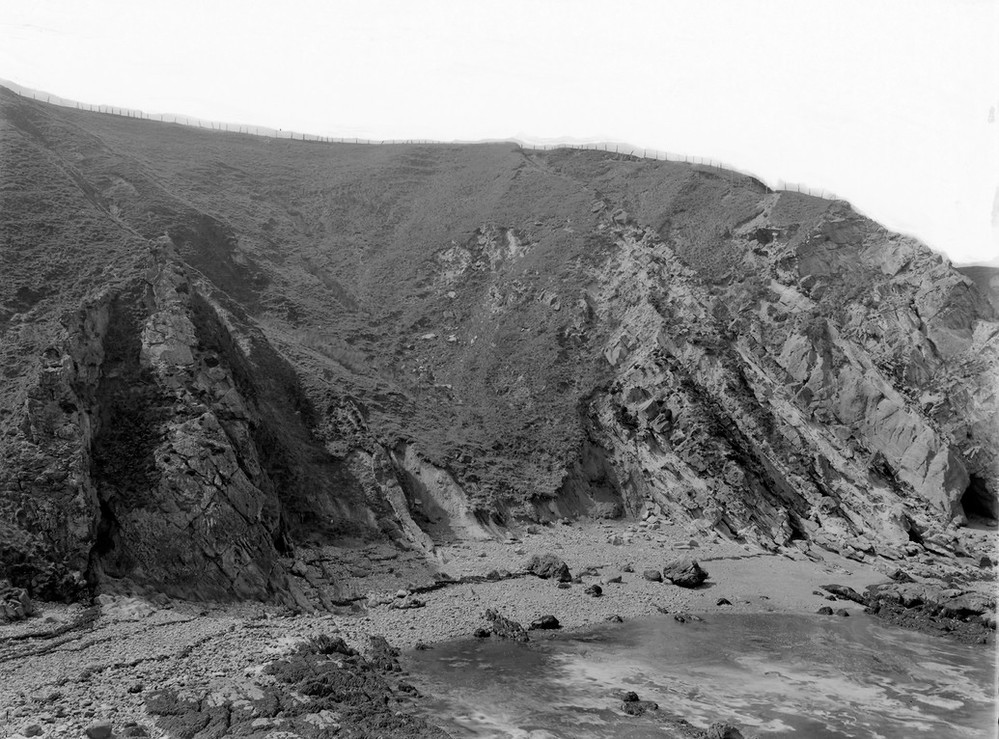
| Caption: | S. side of Cove Harbour, 1.3 km. NE of Cockburnspath. |
| Description: | S. side of Cove Harbour, 1.3 km. NE of Cockburnspath. Beds of Strathclyde Group (formerly Calciferous Sandstone Series) dipping steeply north near a fault. Thin seams of coal, fireclay (near centre of picture) overlain by sandstone on the right. |
| Date taken: | Thu Jan 01 00:00:00 GMT 1914 |
| Photographer: | Lunn, R. |
| Copyright statement: | Crown |
| X longitude/easting: | 378500 |
| Y latitude/northing: | 671500 |
| Coordinate reference system, ESPG code: | 27700 (OSGB 1936 / British National Grid) |
| Orientation: | Landscape |
| Size: | 232.25 KB; 999 x 739 pixels; 85 x 63 mm (print at 300 DPI); 264 x 196 mm (screen at 96 DPI); |
| Average Rating: | Not yet rated |
| Categories: | Unsorted Images, Geoscience subjects/ Stratigraphical |
Loading...
Loading...
Reviews
There is currently no feedback