| P number: | P001118 |
|---|---|
| Old photograph number: | D03694 |
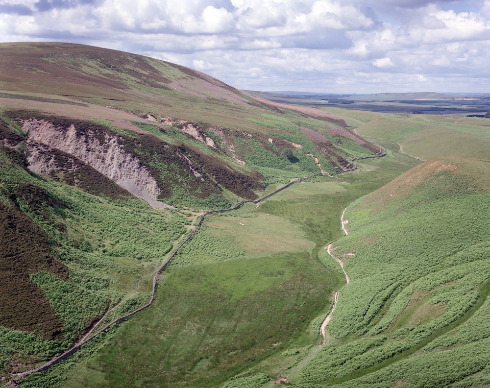
| Caption: | South-west slope of Black Hill, looking west along Bavelaw-Loganlea glacial drainage channel, Pentland Hills. |
| Description: | South-west slope of Black Hill, looking west along Bavelaw-Loganlea glacial drainage channel, Pentland Hills. Glacial drainage channel along north slope of Hare Hill. Water flowed from west to east. Gulleys on left of channel cut in Silurian strata. Note alluvial cones on floor of channel and the very gentle gradient and flat bottom of the channel. This and other Pentland Hills through-routes were formed as late-glacial drainage channels carrying meltwaters from the receding glaciers. |
| Date taken: | Tue Jul 01 00:00:00 BST 1986 |
| Photographer: | Bain, T.S. |
| Copyright statement: | NERC |
| Acknowledgment: | This image was digitized with grant-in-aid from SCRAN the Scottish Cultural Resources Access Network |
| X longitude/easting: | 318100 |
| Y latitude/northing: | 662300 |
| Coordinate reference system, ESPG code: | 27700 (OSGB 1936 / British National Grid) |
| Orientation: | Landscape |
| Size: | 326.55 KB; 1000 x 792 pixels; 85 x 67 mm (print at 300 DPI); 265 x 210 mm (screen at 96 DPI); |
| Average Rating: | Not yet rated |
| Categories: | Unsorted Images |
Loading...
Loading...
Reviews
There is currently no feedback