| P number: | P001115 |
|---|---|
| Old photograph number: | D03690 |
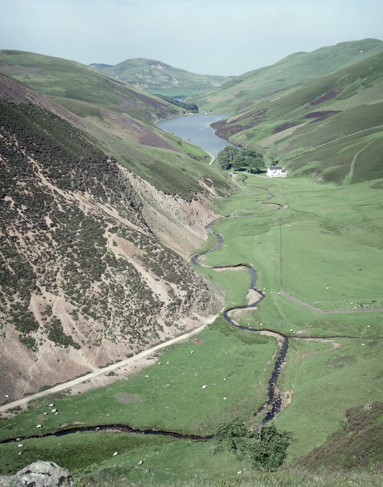
| Caption: | The Howe, Pentlands. Logan Burn. View down valley of Logan Burn from above the Howe showing Loganlea and Glencorse reservoirs. |
| Description: | The Howe, Pentlands. Logan Burn. View down valley of Logan Burn from above the Howe showing Loganlea and Glencorse reservoirs. Left foreground: south slope of Black Hill showing felsite and Silurian rocks; slope to left of Loganlea Reservoir in basalt and basaltic tuff; Castlelaw Hill in distance is composed of rhyolite. East of Loganlea Reservoir, slope of Turnhouse Hill mainly in basalt. |
| Date taken: | Tue Jul 01 00:00:00 BST 1986 |
| Photographer: | Bain, T.S. |
| Copyright statement: | NERC |
| Acknowledgment: | This image was digitized with grant-in-aid from SCRAN the Scottish Cultural Resources Access Network |
| X longitude/easting: | 318600 |
| Y latitude/northing: | 661800 |
| Coordinate reference system, ESPG code: | 27700 (OSGB 1936 / British National Grid) |
| Orientation: | Portrait |
| Size: | 316.85 KB; 787 x 1000 pixels; 67 x 85 mm (print at 300 DPI); 208 x 265 mm (screen at 96 DPI); |
| Average Rating: | Not yet rated |
| Categories: | Unsorted Images |
Loading...
Loading...
Reviews
There is currently no feedback