| P number: | P001114 |
|---|---|
| Old photograph number: | D03689 |
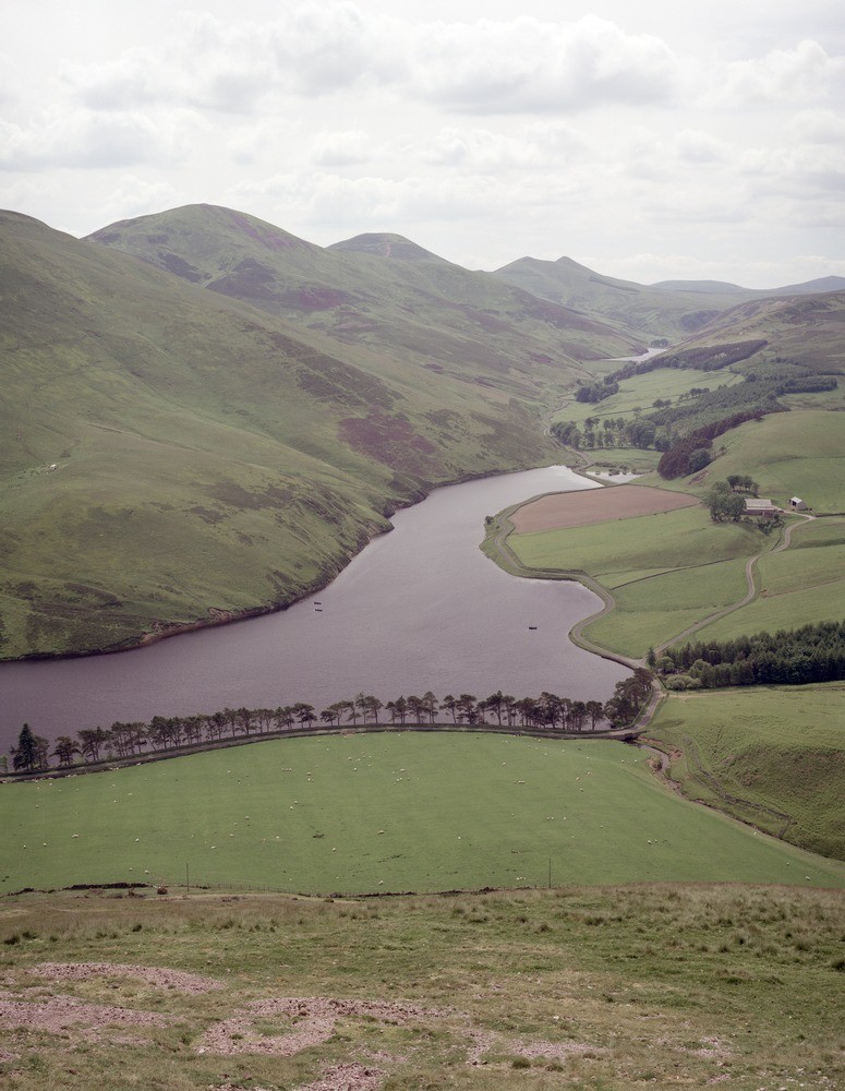
| Caption: | Pentland Hills (Turnhouse to West Kip). From south-west slope of Castlelaw Hill looking up the Logan Valley, with Glencorse Reservoir in foreground and Loganlea Reservoir in distance. |
| Description: | Pentland Hills (Turnhouse to West Kip). From south-west slope of Castlelaw Hill looking up the Logan Valley, with Glencorse Reservoir in foreground and Loganlea Reservoir in distance. Hills (left to right): Turnhouse Hill (basalt and andesite on slope, rhyolite tuff and rhyolite on summit), Carnethy Hill (ditto), Scald Law (basalt, andesite on north-west slope, rhyolite tuff and trachyte on top), East and West Kip Hill (all basalt and andesite), basaltic tuff forms the valley in the foreground. The present topographic pattern of the Pentland Hills was initiated in the Tertiary and later modified by the Pleistocene glaciation. |
| Date taken: | Tue Jul 01 00:00:00 BST 1986 |
| Photographer: | Bain, T.S. |
| Copyright statement: | NERC |
| Acknowledgment: | This image was digitized with grant-in-aid from SCRAN the Scottish Cultural Resources Access Network |
| X longitude/easting: | 322000 |
| Y latitude/northing: | 664400 |
| Coordinate reference system, ESPG code: | 27700 (OSGB 1936 / British National Grid) |
| Orientation: | Portrait |
| Size: | 210.87 KB; 775 x 1000 pixels; 66 x 85 mm (print at 300 DPI); 205 x 265 mm (screen at 96 DPI); |
| Average Rating: | Not yet rated |
| Categories: | Unsorted Images |
Loading...
Loading...
Reviews
There is currently no feedback