| P number: | P216015 |
|---|---|
| Old photograph number: | C01844 |
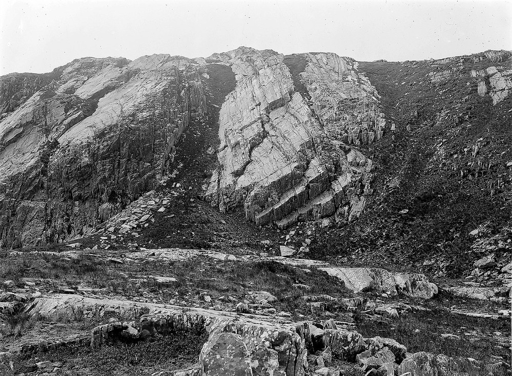
| Caption: | N. of Stob Ban, 6.4 km. W. of Loch Treig. |
| Description: | N. of Stob Ban, 6.4 km. W. of Loch Treig. Folding in quartzites (near view of centre part of No. C1843). Glaciated rocks in foreground on floor of col indicating overflow of ice between valleys. |
| Date taken: | Sat Jan 01 00:00:00 GMT 1910 |
| Photographer: | Lunn, R. |
| Copyright statement: | Crown |
| X longitude/easting: | 226500 |
| Y latitude/northing: | 772500 |
| Coordinate reference system, ESPG code: | 27700 (OSGB 1936 / British National Grid) |
| Orientation: | Landscape |
| Size: | 377.80 KB; 999 x 734 pixels; 85 x 62 mm (print at 300 DPI); 264 x 194 mm (screen at 96 DPI); |
| Average Rating: | Not yet rated |
| Categories: | Unsorted Images |
Loading...
Loading...
Reviews
There is currently no feedback