| P number: | P001108 |
|---|---|
| Old photograph number: | D03683 |
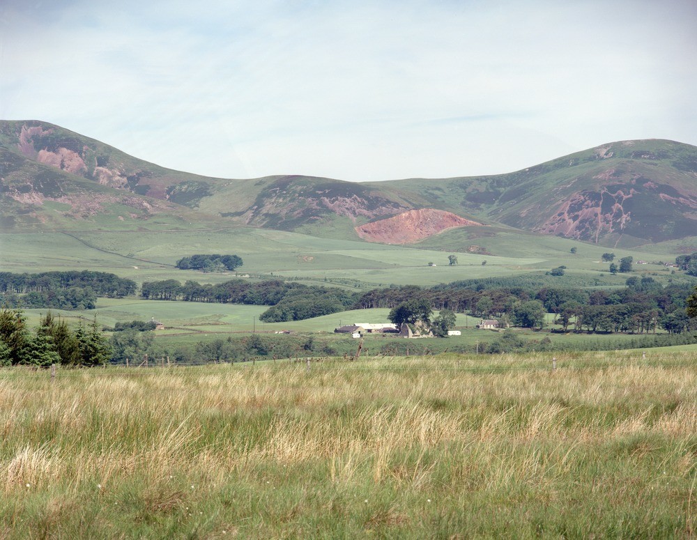
| Caption: | A photograph taken of the Pentland Hills from Harlaw Muir, Penicuik, Midlothian. The pink gash in the centre is Silverburn Quarry. The ruined castle in the foreground is at Brunstane Farm. |
| Description: | A photograph taken of the Pentland Hills from Harlaw Muir, Penicuik, Midlothian. The pink gash in the centre is Silverburn Quarry. The ruined castle in the foreground is at Brunstane Farm. From left to right is Scald Law, the pink face is trachyte; Silverburn Quarry, partly in trachyte but mainly in basalt; Carnethy Hill (pink face in foreground with developed scree, in trachyte while its summit is rhyolitic tuff). |
| Date taken: | Tue Jul 01 00:00:00 BST 1986 |
| Photographer: | Bain, T.S. |
| Copyright statement: | NERC |
| Acknowledgment: | This image was digitized with grant-in-aid from SCRAN the Scottish Cultural Resources Access Network |
| X longitude/easting: | 320200 |
| Y latitude/northing: | 656800 |
| Coordinate reference system, ESPG code: | 27700 (OSGB 1936 / British National Grid) |
| Orientation: | Landscape |
| Size: | 263.42 KB; 1000 x 775 pixels; 85 x 66 mm (print at 300 DPI); 265 x 205 mm (screen at 96 DPI); |
| Average Rating: | Not yet rated |
| Categories: | Unsorted Images |
Loading...
Loading...
Reviews
There is currently no feedback