| P number: | P001106 |
|---|---|
| Old photograph number: | D03681 |
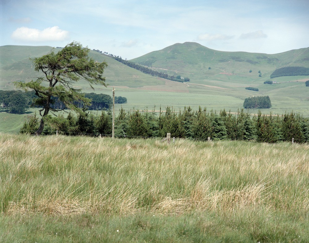
| Caption: | West Kip. View from Harlaw Muir, Penicuik - West Linton Road to north-west. The hills are from left to right, Braid Law (rhyolite), West Kip and East Kip (just off) (both in basalt). |
| Description: | West Kip. View from Harlaw Muir, Penicuik - West Linton Road to north-west. The hills are from left to right, Braid Law (rhyolite), West Kip and East Kip (just off) (both in basalt). The Pentland fault coinciding with change of slope in middle distance is a major fault separating the older Old Red Sandstone volcanics of the Pentland Hills from the Carboniferous rocks of the Midlothian Coalfield. |
| Date taken: | Tue Jul 01 00:00:00 BST 1986 |
| Photographer: | Bain, T.S. |
| Copyright statement: | NERC |
| Acknowledgment: | This image was digitized with grant-in-aid from SCRAN the Scottish Cultural Resources Access Network |
| X longitude/easting: | 320200 |
| Y latitude/northing: | 656800 |
| Coordinate reference system, ESPG code: | 27700 (OSGB 1936 / British National Grid) |
| Orientation: | Landscape |
| Size: | 310.50 KB; 1000 x 785 pixels; 85 x 66 mm (print at 300 DPI); 265 x 208 mm (screen at 96 DPI); |
| Average Rating: | Not yet rated |
| Categories: | Unsorted Images |
Loading...
Loading...
Reviews
There is currently no feedback