| P number: | P001093 |
|---|---|
| Old photograph number: | D03663 |
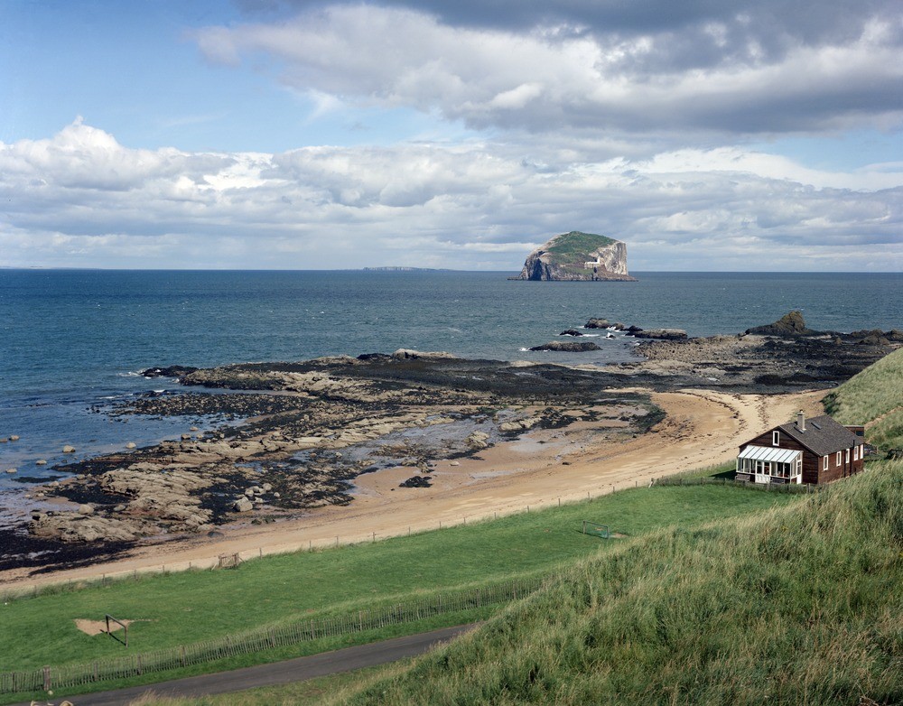
| Caption: | Bass Rock from Canty Bay, East Lothian. |
| Description: | The Bass Rock situated in the entrance to the Firth of Forth is 3.75 miles east-north-east of North Berwick and is over one mile in circumference. It represents solidified magma in the vent of a Carboniferous volcano. The foreshore is composed of bedded tuffs cut by the Gin Head Vent, one of six vents between Cantry Bay and Peffer Sands of the Garleton Hills Volcanic Rocks (Carboniferous). Isle of May in the distance. This islet is the most famous topographical feature in the Dunbar area, and is known to geologists as a classical volcanic plug and a widely visible landmark. The phonolitic trachyte plug is an intrusion related to the Carboniferous Garleton Hills Volcanic Rocks. |
| Date taken: | Tue Jan 01 00:00:00 GMT 1985 |
| Photographer: | Bain, T.S. |
| Copyright statement: | NERC |
| Acknowledgment: | This image was digitized with grant-in-aid from SCRAN the Scottish Cultural Resources Access Network |
| X longitude/easting: | 358600 |
| Y latitude/northing: | 685100 |
| Coordinate reference system, ESPG code: | 27700 (OSGB 1936 / British National Grid) |
| Orientation: | Landscape |
| Size: | 268.85 KB; 1000 x 782 pixels; 85 x 66 mm (print at 300 DPI); 265 x 207 mm (screen at 96 DPI); |
| Average Rating: | Not yet rated |
| Categories: | Unsorted Images |
Loading...
Loading...
Reviews
There is currently no feedback