| P number: | P215113 |
|---|---|
| Old photograph number: | C00609 |
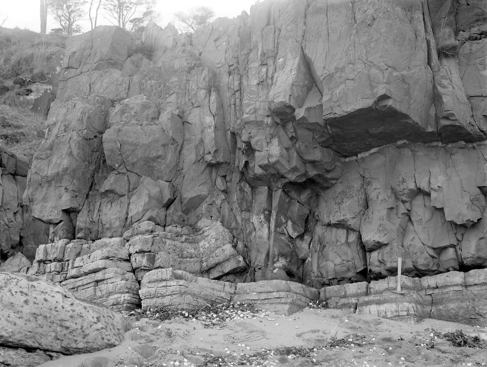
| Caption: | Hound Point, 3.2 km. NE of South Queensferry. |
| Description: | Hound Point, 3.2 km. NE of South Queensferry. Base of sill of intrusive dolerite, cutting across the bedding and forcing up the Lower Carboniferous sandstone. |
| Date taken: | Fri Jan 01 00:00:00 GMT 1892 |
| Photographer: | Lunn, R. |
| Copyright statement: | Crown |
| X longitude/easting: | 315500 |
| Y latitude/northing: | 579500 |
| Coordinate reference system, ESPG code: | 27700 (OSGB 1936 / British National Grid) |
| Orientation: | Landscape |
| Size: | 278.69 KB; 1000 x 755 pixels; 85 x 64 mm (print at 300 DPI); 265 x 200 mm (screen at 96 DPI); |
| Average Rating: | Not yet rated |
| Categories: | Unsorted Images, Geoscience subjects/ Igneous features/ Sills |
Loading...
Loading...
Reviews
There is currently no feedback