| P number: | P214941 |
|---|---|
| Old photograph number: | C00392 |
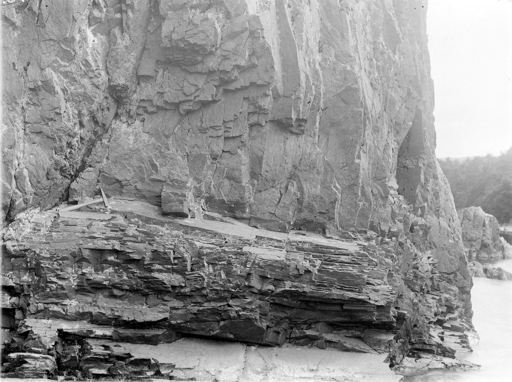
| Caption: | River Garry, 0.8 km. W. of Clunes, 2.6 km. WNW of Struan Station. |
| Description: | River Garry, 0.8 km. W. of Clunes, 2.6 km. WNW of Struan Station. Sill of quartz-porphyry in the Moine gneisses (shows contrast in the mode of weathering of the two rocks). |
| Date taken: | Wed Jan 01 00:00:00 GMT 1902 |
| Photographer: | Lunn, R. |
| Copyright statement: | Crown |
| X longitude/easting: | 277400 |
| Y latitude/northing: | 767700 |
| Coordinate reference system, ESPG code: | 27700 (OSGB 1936 / British National Grid) |
| Orientation: | Landscape |
| Size: | 284.76 KB; 1000 x 747 pixels; 85 x 63 mm (print at 300 DPI); 265 x 198 mm (screen at 96 DPI); |
| Average Rating: | Not yet rated |
| Categories: | Unsorted Images, Geoscience subjects/ Igneous features/ Sills |
Loading...
Loading...
Reviews
There is currently no feedback