| P number: | P214904 |
|---|---|
| Old photograph number: | C00349 |
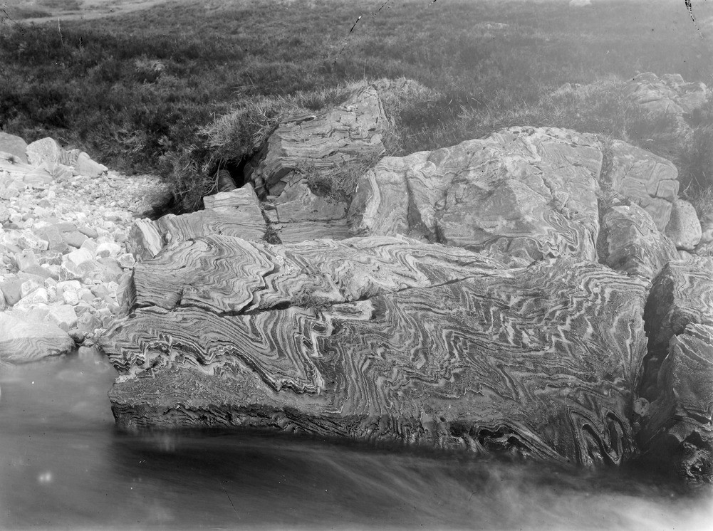
| Caption: | Near (below), Alltanodhar Shieling, Ey Burn, 10.4 km. SW of Braemar. |
| Description: | Near (below), Alltanodhar Shieling, Ey Burn, 10.4 km. SW of Braemar. Contorted ribbed limestone showing an epitome of the structure of the whole region. |
| Date taken: | Sat Jan 01 00:00:00 GMT 1898 |
| Photographer: | Lunn, R. |
| Copyright statement: | Crown |
| X longitude/easting: | 308500 |
| Y latitude/northing: | 782400 |
| Coordinate reference system, ESPG code: | 27700 (OSGB 1936 / British National Grid) |
| Orientation: | Landscape |
| Size: | 270.23 KB; 1001 x 746 pixels; 85 x 63 mm (print at 300 DPI); 265 x 197 mm (screen at 96 DPI); |
| Average Rating: | Not yet rated |
| Categories: | Unsorted Images, Geoscience subjects/ Structural features/ Folding |
Loading...
Loading...
Reviews
There is currently no feedback