| P number: | P001021 |
|---|---|
| Old photograph number: | D03237 |
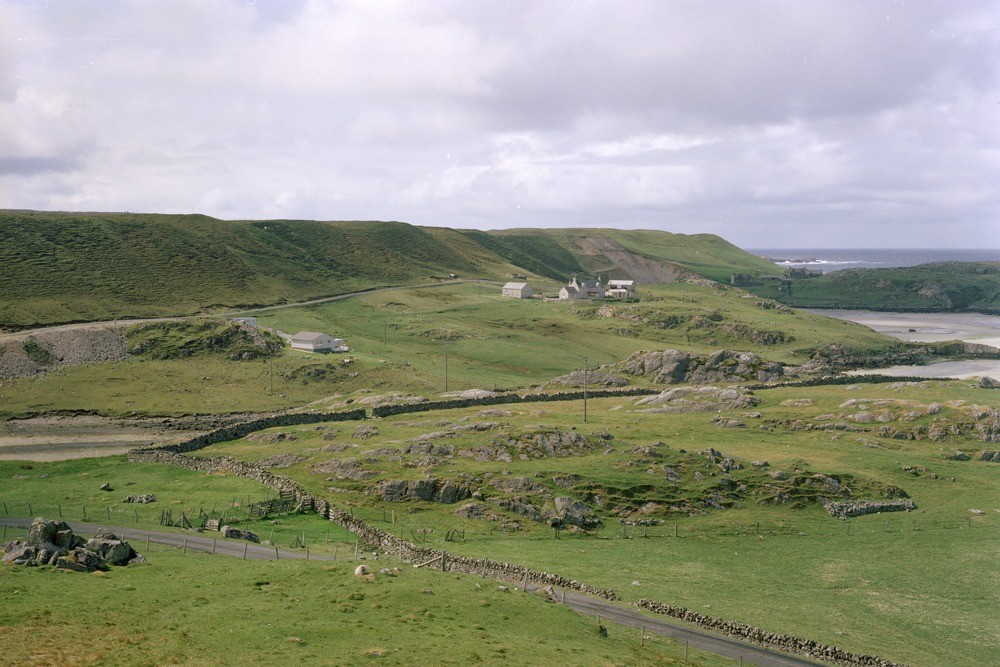
| Caption: | Carnish, west Lewis. Outer Hebrides. A glaciofluvial delta or terrace at or a little above 50 metres O.D. is underlain by sand and gravel covering an area of 0.5 square kilometres. The scale is given by farm buildings. |
| Description: | Carnish, west Lewis. Outer Hebrides. A glaciofluvial delta or terrace at or a little above 50 metres O.D. is underlain by sand and gravel covering an area of 0.5 square kilometres. The scale is given by farm buildings. It has been suggested that the material has been deposited as a delta in a lake held up by ice to the west. The kettled surface of the terrace and evidence from the large foresets (sedimentary structures) where exposed, suggest transport of the material from the west. |
| Date taken: | Tue Jan 01 00:00:00 GMT 1980 |
| Photographer: | Pulsford, J.M. |
| Copyright statement: | NERC |
| Acknowledgment: | This image was digitized with grant-in-aid from SCRAN the Scottish Cultural Resources Access Network |
| X longitude/easting: | 103700 |
| Y latitude/northing: | 931700 |
| Coordinate reference system, ESPG code: | 27700 (OSGB 1936 / British National Grid) |
| Orientation: | Landscape |
| Size: | 208.92 KB; 1000 x 667 pixels; 85 x 56 mm (print at 300 DPI); 265 x 176 mm (screen at 96 DPI); |
| Average Rating: | Not yet rated |
| Categories: | Unsorted Images |
Loading...
Loading...
Reviews
There is currently no feedback