| P number: | P214751 |
|---|---|
| Old photograph number: | C00154 |
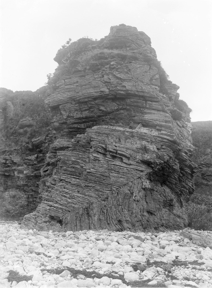
| Caption: | Shore 1.6 km. S. of Sandaig, about 8.0 km. SSW of Glenelg. |
| Description: | Shore 1.6 km. S. of Sandaig, about 8.0 km. SSW of Glenelg. General view of cliff, showing thinly banded biotite granulites, with some basic knots. An axial plane of fold is shown in the lower part of the cliff (Lewisian Gneiss Series). |
| Date taken: | Sun Jan 01 00:00:00 GMT 1905 |
| Photographer: | Lunn, R. |
| Copyright statement: | Crown |
| X longitude/easting: | 177500 |
| Y latitude/northing: | 812600 |
| Coordinate reference system, ESPG code: | 27700 (OSGB 1936 / British National Grid) |
| Orientation: | Portrait |
| Size: | 246.09 KB; 738 x 1001 pixels; 62 x 85 mm (print at 300 DPI); 195 x 265 mm (screen at 96 DPI); |
| Average Rating: | Not yet rated |
| Categories: | Unsorted Images, Geoscience subjects/ Structural features/ Folding |
Loading...
Loading...
Reviews
There is currently no feedback