| P number: | P214742 |
|---|---|
| Old photograph number: | C00145 |
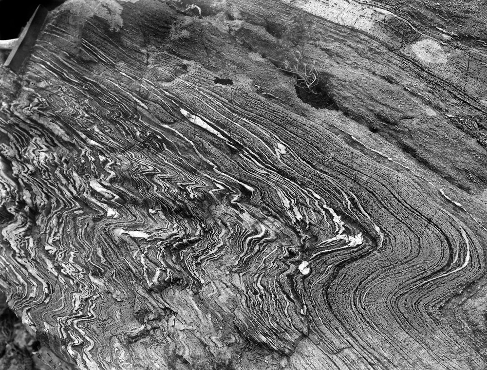
| Caption: | Hillside, nearly 0.8 km. WSW of Mam nan Uranan, 4.0 km. SSW of Glenelg. |
| Description: | Hillside, nearly 0.8 km. WSW of Mam nan Uranan, 4.0 km. SSW of Glenelg. Moine schist near the supposed conglomerate-schist. Indications of pebbly characer can be discerned in places. |
| Date taken: | Sun Jan 01 00:00:00 GMT 1905 |
| Photographer: | Lunn, R. |
| Copyright statement: | Crown |
| X longitude/easting: | 179000 |
| Y latitude/northing: | 816700 |
| Coordinate reference system, ESPG code: | 27700 (OSGB 1936 / British National Grid) |
| Orientation: | Landscape |
| Size: | 432.93 KB; 1000 x 760 pixels; 85 x 64 mm (print at 300 DPI); 265 x 201 mm (screen at 96 DPI); |
| Average Rating: | Not yet rated |
| Categories: | Unsorted Images, Geoscience subjects/ Stratigraphical, Geoscience subjects/ Metamorphic features/ Foliation, Geoscience subjects/ Rocks, metamorphic/ Schists |
Loading...
Loading...
Reviews
There is currently no feedback