| P number: | P001006 |
|---|---|
| Old photograph number: | D03191 |
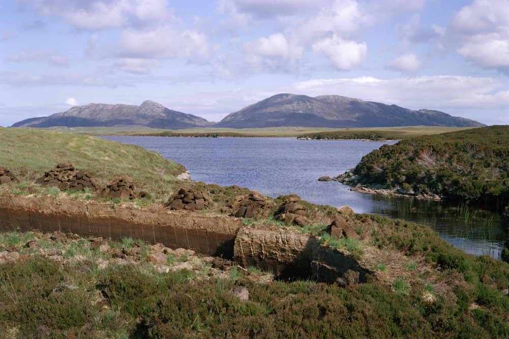
| Caption: | Roadside (A 867) west of Loch Maddy, looking south-east. North Uist, Outer Hebrides. Lewisian scenery. Flat peat-covered central North Uist with upstanding hills - North Lee and South Lee of Lewisian above Outer Hebrides Thrust Zone. |
| Description: | Roadside (A 867) west of Loch Maddy, looking south-east. North Uist, Outer Hebrides. Lewisian scenery. Flat peat-covered central North Uist with upstanding hills - North Lee and South Lee of Lewisian above Outer Hebrides Thrust Zone. The Lees are formed of pseudotachylite which has welded together the otherwise broken and friable gneiss of the thrust zone making the rock more resistant to weathering and giving rise to the prominent hills. The pseudotachylite is a dense, black, flinty rock thought to have formed by the brittle fracturing of the gneiss resulting in local melting by frictional sliding. The hot molten material is injected into the adjacent gneiss to form an intricate vein network of black glass. |
| Date taken: | Tue Jan 01 00:00:00 GMT 1980 |
| Photographer: | Pulsford, J.M. |
| Copyright statement: | NERC |
| Acknowledgment: | This image was digitized with grant-in-aid from SCRAN the Scottish Cultural Resources Access Network |
| X longitude/easting: | 87800 |
| Y latitude/northing: | 867800 |
| Coordinate reference system, ESPG code: | 27700 (OSGB 1936 / British National Grid) |
| Orientation: | Landscape |
| Size: | 246.93 KB; 1001 x 667 pixels; 85 x 56 mm (print at 300 DPI); 265 x 176 mm (screen at 96 DPI); |
| Average Rating: | Not yet rated |
| Categories: | Best of BGS Images/ Landscapes, Geoscience subjects/ General views |
Loading...
Loading...
Reviews
There is currently no feedback