| P number: | P001003 |
|---|---|
| Old photograph number: | D03172 |
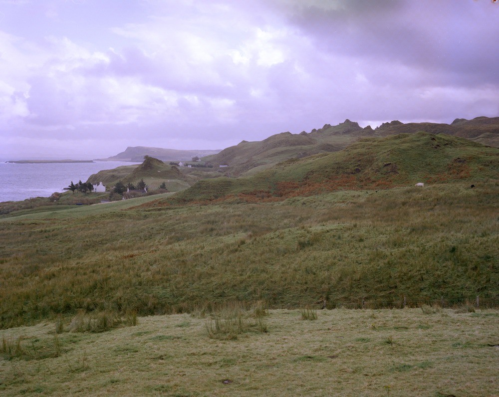
| Caption: | Landslip topography south of Flodigarry Hotel. Skye. In the foreground slipped masses of Tertiary lava and Jurassic sediments. In the distance the headland of Rubha Garbhaig is of Tertiary dolerite sills in Jurassic sediments. |
| Description: | Landslip topography south of Flodigarry Hotel. Skye. In the foreground slipped masses of Tertiary lava and Jurassic sediments. In the distance the headland of Rubha Garbhaig is of Tertiary dolerite sills in Jurassic sediments. Part of the Quiraing landslip, the greatest landslip in Skye and Britain extending 7000 feet from the scarp of Meall nan Suiramach to the coast here in Staffin Bay. It is a stable and mature slip except near Flodigarry where the toe is being actively removed by the sea, here there is continuous but not extensive movement. |
| Date taken: | Tue Jan 01 00:00:00 GMT 1980 |
| Photographer: | Bain, T.S. |
| Copyright statement: | NERC |
| Acknowledgment: | This image was digitized with grant-in-aid from SCRAN the Scottish Cultural Resources Access Network |
| X longitude/easting: | 246250 |
| Y latitude/northing: | 771950 |
| Coordinate reference system, ESPG code: | 27700 (OSGB 1936 / British National Grid) |
| Orientation: | Landscape |
| Size: | 217.80 KB; 1000 x 796 pixels; 85 x 67 mm (print at 300 DPI); 265 x 211 mm (screen at 96 DPI); |
| Average Rating: | Not yet rated |
| Categories: | Unsorted Images |
Loading...
Loading...
Reviews
There is currently no feedback