| P number: | P000995 |
|---|---|
| Old photograph number: | D03060 |
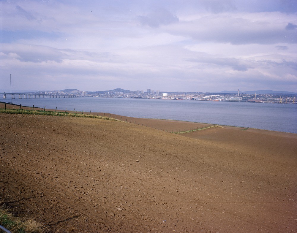
| Caption: | Near Northfield, north-east Fife. Looking west-north-west. At the bottom of the field, marginal to the Firth of Tay, is the Flandrian (post-glacial) raised beach above which, in the middle of the field, is the (late-Devensian) late-glacial beach. |
| Description: | Near Northfield, north-east Fife. Looking west-north-west. At the bottom of the field, marginal to the Firth of Tay, is the Flandrian (post-glacial) raised beach above which, in the middle of the field, is the (late-Devensian) late-glacial beach. Both of these raised beach features are underlain by beach sands and gravels. In the foreground, above the late-glacial beach, glacial till occurs beneath soil. Dundee is situated on the opposite shore. The raised beaches were formed when the land surface was relatively lower due to glacio-isostatic depression imposed by the weight of the late-Devensian ice-sheet. With the removal of the ice sheet the land has now risen considerably leaving many marine features such as these raised beaches well above sea level. |
| Date taken: | Tue Jan 01 00:00:00 GMT 1980 |
| Photographer: | Christie, A. |
| Copyright statement: | NERC |
| Acknowledgment: | This image was digitized with grant-in-aid from SCRAN the Scottish Cultural Resources Access Network |
| X longitude/easting: | 343300 |
| Y latitude/northing: | 729000 |
| Coordinate reference system, ESPG code: | 27700 (OSGB 1936 / British National Grid) |
| Orientation: | Landscape |
| Size: | 217.70 KB; 1000 x 785 pixels; 85 x 66 mm (print at 300 DPI); 265 x 208 mm (screen at 96 DPI); |
| Average Rating: | Not yet rated |
| Categories: | Unsorted Images, Geoscience subjects/ Landforms, marine/ Raised beaches |
Loading...
Loading...
Reviews
There is currently no feedback