| P number: | P000993 |
|---|---|
| Old photograph number: | D03058 |
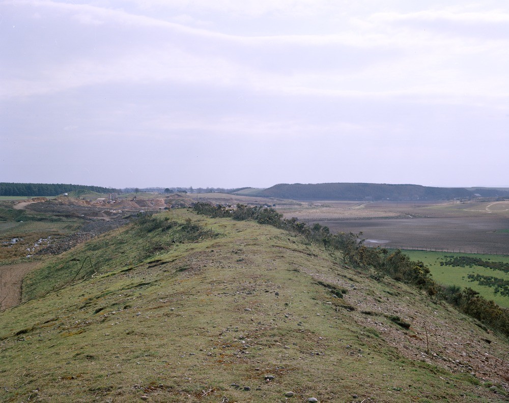
| Caption: | Near Carrick, north-east Fife. Looking east-south-east. Steep-sided esker ridge formed of ill-sorted glacial sand and gravel, containing much boulder and cobble grade material. |
| Description: | Near Carrick, north-east Fife. Looking east-south-east. Steep-sided esker ridge formed of ill-sorted glacial sand and gravel, containing much boulder and cobble grade material. The deposit has been worked by the quarry in the middle distance. The low ground to the south-west of the ridge is underlain by thin alluvial silts and clays of the Motray Water on fluvioglacial sand, the latter deposit also forms the steep-sided hill in the distance. |
| Date taken: | Tue Jan 01 00:00:00 GMT 1980 |
| Photographer: | Christie, A. |
| Copyright statement: | NERC |
| Acknowledgment: | This image was digitized with grant-in-aid from SCRAN the Scottish Cultural Resources Access Network |
| X longitude/easting: | 343300 |
| Y latitude/northing: | 723200 |
| Coordinate reference system, ESPG code: | 27700 (OSGB 1936 / British National Grid) |
| Orientation: | Landscape |
| Size: | 225.43 KB; 1000 x 792 pixels; 85 x 67 mm (print at 300 DPI); 265 x 210 mm (screen at 96 DPI); |
| Average Rating: | Not yet rated |
| Categories: | Unsorted Images, Geoscience subjects/ Landforms, glaciation/ Kames and eskers |
Loading...
Loading...
Reviews
There is currently no feedback