| P number: | P214550 |
|---|---|
| Old photograph number: | B00774 |
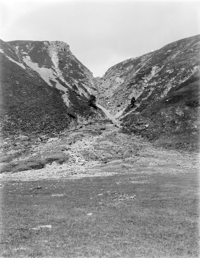
| Caption: | 4.023 km. SSE of Glenfeshie Lodge, 15.289 km. SE of Kingussie. |
| Description: | 4.023 km. SSE of Glenfeshie Lodge, 15.289 km. SE of Kingussie. Hanging gorges, cut through Moine gneiss, descending from the plateau on the north side of Glen Feshie to the overdeepened main valley below. Steep alluvial cone at mouth of gorge. |
| Date taken: | Wed Jan 01 00:00:00 GMT 1913 |
| Photographer: | Lunn, R. |
| Copyright statement: | Crown |
| X longitude/easting: | 286500 |
| Y latitude/northing: | 790500 |
| Coordinate reference system, ESPG code: | 27700 (OSGB 1936 / British National Grid) |
| Orientation: | Portrait |
| Size: | 255.83 KB; 773 x 1000 pixels; 65 x 85 mm (print at 300 DPI); 205 x 265 mm (screen at 96 DPI); |
| Average Rating: | Not yet rated |
| Categories: | Unsorted Images, Geoscience subjects/ Landforms, river/ River terraces and cliffs |
Loading...
Loading...
Reviews
There is currently no feedback