| P number: | P000983 |
|---|---|
| Old photograph number: | D03018 |
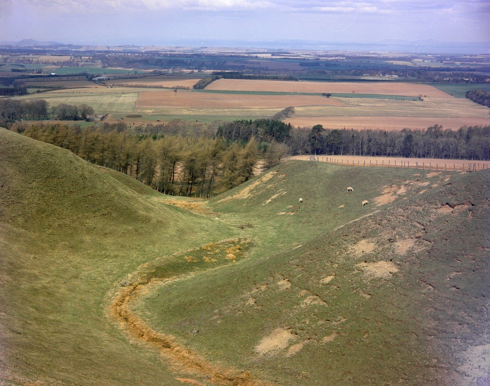
| Caption: | North scarp, Lammermuir Hills, 0.7 km. east-south-east of Blegbie Farm. East Lothian. Glacial drainage channel (subglacial chute). A view, looking north-west, down a prominent subglacial chute. |
| Description: | North scarp, Lammermuir Hills, 0.7 km. east-south-east of Blegbie Farm. East Lothian. Glacial drainage channel (subglacial chute). A view, looking north-west, down a prominent subglacial chute. During deglaciation, while ice was banked up against the north slopes of the Lammermuir Hills, a series of sinuous marginal glacial drainage channels were cut by meltwater flowing along the ice margin, and subglacial chutes were formed by water flowing under the ice. |
| Date taken: | Mon Jan 01 00:00:00 GMT 1979 |
| Photographer: | Bain, T.S. |
| Copyright statement: | NERC |
| Acknowledgment: | This image was digitized with grant-in-aid from SCRAN the Scottish Cultural Resources Access Network |
| X longitude/easting: | 348780 |
| Y latitude/northing: | 661370 |
| Coordinate reference system, ESPG code: | 27700 (OSGB 1936 / British National Grid) |
| Orientation: | Landscape |
| Size: | 296.41 KB; 1000 x 789 pixels; 85 x 67 mm (print at 300 DPI); 265 x 209 mm (screen at 96 DPI); |
| Average Rating: | Not yet rated |
| Categories: | Unsorted Images |
Loading...
Loading...
Reviews
There is currently no feedback