| P number: | P000965 |
|---|---|
| Old photograph number: | D02820 |
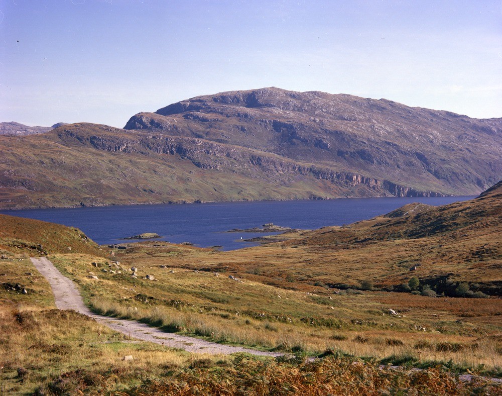
| Caption: | Loch Glencoul. Looking towards the north-east across the loch from the track going down to Newton. Sutherland. |
| Description: | Above the scarp lies a peaty platform composed of Cambrian Pipe Rock with some 'Fucoid' Beds at the eastern edge. Above the platform rises gneiss which has been carried on the combined Sole and Glencoul Thrust Planes and forms the main hill of Aird da Loch. Glencoul Thrust Plane: on the far side of the loch is the peninsula of Aird da Loch. Undisturbed easterly-dipping Cambrian quartzites can be seen forming the prominent scarp above the grey knolls of Lewisian gneiss. |
| Date taken: | Sat Sep 01 00:00:00 BST 1979 |
| Photographer: | Bain, T.S. |
| Copyright statement: | NERC |
| Acknowledgment: | This image was digitized with grant-in-aid from SCRAN the Scottish Cultural Resources Access Network |
| X longitude/easting: | 223400 |
| Y latitude/northing: | 931600 |
| Coordinate reference system, ESPG code: | 27700 (OSGB 1936 / British National Grid) |
| Orientation: | Landscape |
| Size: | 302.45 KB; 1000 x 788 pixels; 85 x 67 mm (print at 300 DPI); 265 x 208 mm (screen at 96 DPI); |
| Average Rating: | Not yet rated |
| Categories: | Best of BGS Images/ Geological structures |
Loading...
Loading...
Reviews
There is currently no feedback