| P number: | P000949 |
|---|---|
| Old photograph number: | D02776 |
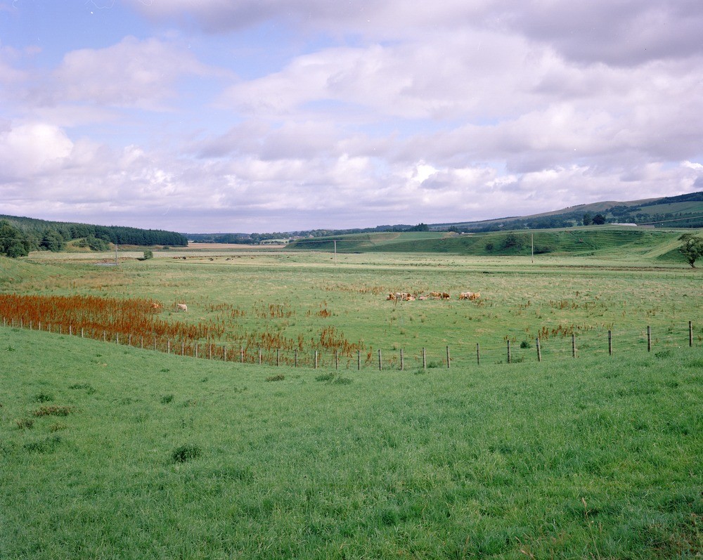
| Caption: | Valley of the Douglas Water, south-west of Douglas taken from Hazelside road-end. Lanarkshire. Looking north-east. The wide flood plain with its meandering river is bordered by terraces composed of fluvioglacial sand and gravel. |
| Description: | Valley of the Douglas Water, south-west of Douglas taken from Hazelside road-end. Lanarkshire. Looking north-east. The wide flood plain with its meandering river is bordered by terraces composed of fluvioglacial sand and gravel. These deposits on the eastern valley side, at Weston Farm, are more extensive and thickly developed than those to the west and form a prominent feature. |
| Date taken: | Mon Jan 01 00:00:00 GMT 1979 |
| Photographer: | Christie, A. |
| Copyright statement: | NERC |
| Acknowledgment: | This image was digitized with grant-in-aid from SCRAN the Scottish Cultural Resources Access Network |
| X longitude/easting: | 281700 |
| Y latitude/northing: | 628700 |
| Coordinate reference system, ESPG code: | 27700 (OSGB 1936 / British National Grid) |
| Orientation: | Landscape |
| Size: | 263.10 KB; 1000 x 797 pixels; 85 x 67 mm (print at 300 DPI); 265 x 211 mm (screen at 96 DPI); |
| Average Rating: | Not yet rated |
| Categories: | Unsorted Images |
Loading...
Loading...
Reviews
There is currently no feedback