| P number: | P000940 |
|---|---|
| Old photograph number: | D02736 |
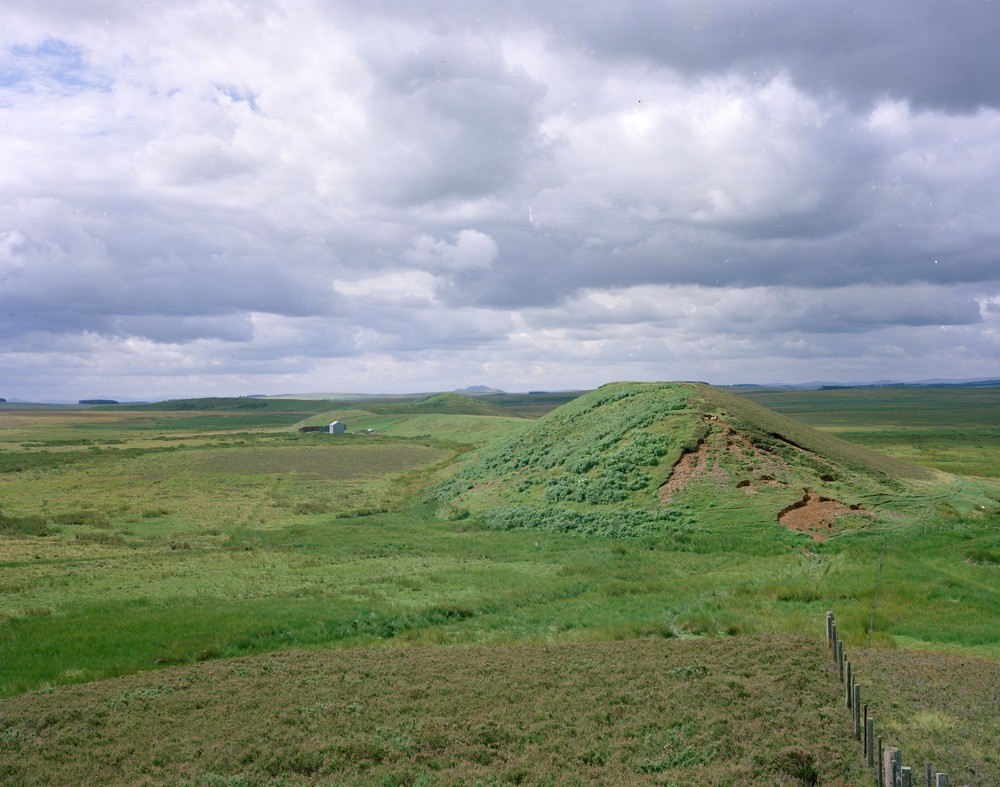
| Caption: | Bedshiel Kaims. Berwickshire. North-east end of the esker, known as Bedshiel Kaims. The view looking to the south-west shows 'Horse Kaim' and on the left of the picture, in shadow, 'Green Kaims'. |
| Description: | Bedshiel Kaims. Berwickshire. North-east end of the esker, known as Bedshiel Kaims. The view looking to the south-west shows 'Horse Kaim' and on the left of the picture, in shadow, 'Green Kaims'. The esker varies in height between 6 m. and 12 m. above the flattish surface of glacial till on which it rests. Patches of peat and alluvium have formed on either side of the esker. Eskers are a fluvioglacial landform formed at the retreating edge of a glacier or in a subglacial or englacial tunnel. |
| Date taken: | Mon Jan 01 00:00:00 GMT 1979 |
| Photographer: | Christie, A. |
| Copyright statement: | NERC |
| Acknowledgment: | This image was digitized with grant-in-aid from SCRAN the Scottish Cultural Resources Access Network |
| X longitude/easting: | 370700 |
| Y latitude/northing: | 651200 |
| Coordinate reference system, ESPG code: | 27700 (OSGB 1936 / British National Grid) |
| Orientation: | Landscape |
| Size: | 219.21 KB; 1000 x 787 pixels; 85 x 67 mm (print at 300 DPI); 265 x 208 mm (screen at 96 DPI); |
| Average Rating: | Not yet rated |
| Categories: | Unsorted Images, Geoscience subjects/ Landforms, glaciation/ Kames and eskers |
Loading...
Loading...
Reviews
There is currently no feedback