| P number: | P000936 |
|---|---|
| Old photograph number: | D02705 |
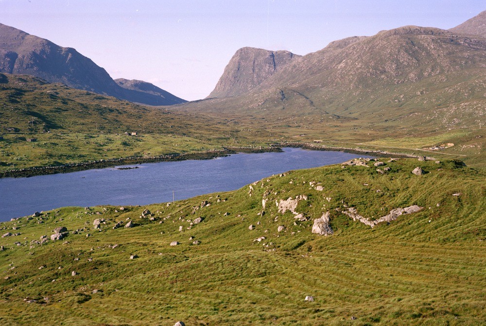
| Caption: | Looking north from Tolmachan along Glen Meavaig. North Harris. Outer Hebrides. The photograph shows mountainous rocky Lewisian topography. In the distance is the steep cliff of Sron Scourst. |
| Description: | Looking north from Tolmachan along Glen Meavaig. North Harris. Outer Hebrides. The photograph shows mountainous rocky Lewisian topography. In the distance is the steep cliff of Sron Scourst. The valleys are fault controlled. A fault runs from the south-west to north-east along the loch, while another fault runs from the vicinity of the head of the loch up the valley, due north, to the head of Loch Resort. Morainic drift occurs in much of the valley. |
| Date taken: | Sun Jan 01 00:00:00 GMT 1978 |
| Photographer: | Christie, A. |
| Copyright statement: | NERC |
| Acknowledgment: | This image was digitized with grant-in-aid from SCRAN the Scottish Cultural Resources Access Network |
| X longitude/easting: | 109700 |
| Y latitude/northing: | 905400 |
| Coordinate reference system, ESPG code: | 27700 (OSGB 1936 / British National Grid) |
| Orientation: | Landscape |
| Size: | 284.52 KB; 1000 x 671 pixels; 85 x 57 mm (print at 300 DPI); 265 x 178 mm (screen at 96 DPI); |
| Average Rating: | Not yet rated |
| Categories: | Unsorted Images, Geoscience subjects/ General views |
Loading...
Loading...
Reviews
There is currently no feedback