| P number: | P213354 |
|---|---|
| Old photograph number: | A14584 |
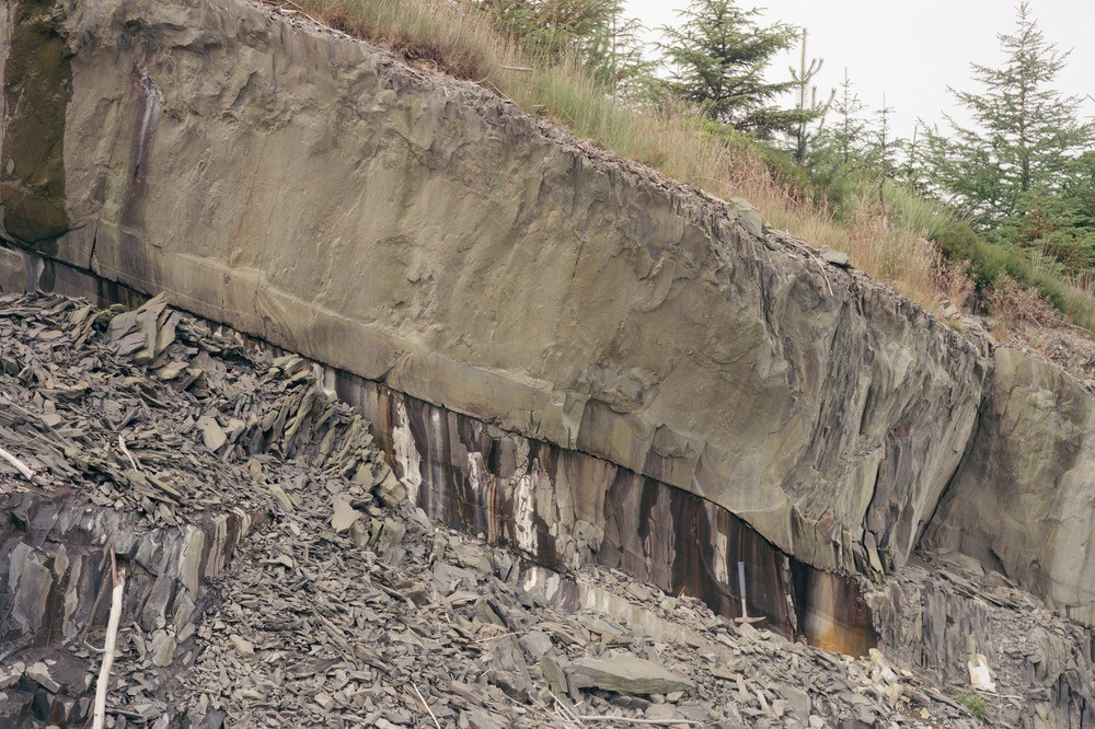
| Caption: | Forestry track, 1.5 km. S. of Port Mawr, near Llanguric. |
| Description: | Forestry track, 1.5 km. S. of Port Mawr, near Llanguric. Thick high-matrix sandstone unit resting on turbiditic mudstones in the Upper Llandovery (Rhuddnant Grits'). The mudstones and the argillaceous parts of the sandstone are cleaved. The upper part of the sandstone contains mud clasts and irregular dewatering structures. |
| Date taken: | Fri Jan 01 00:00:00 GMT 1988 |
| Photographer: | Cullen, T. |
| Copyright statement: | NERC |
| X longitude/easting: | 284400 |
| Y latitude/northing: | 381000 |
| Coordinate reference system, ESPG code: | 27700 (OSGB 1936 / British National Grid) |
| Orientation: | Landscape |
| Size: | 308.88 KB; 1000 x 666 pixels; 85 x 56 mm (print at 300 DPI); 265 x 176 mm (screen at 96 DPI); |
| Average Rating: | Not yet rated |
| Categories: | Unsorted Images, Geoscience subjects/ Sedimentary features/ Turbidites |
Loading...
Loading...
Reviews
There is currently no feedback