| P number: | P000885 |
|---|---|
| Old photograph number: | D02536 |
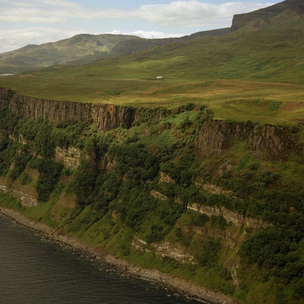
| Caption: | Oblique aerial view of the north of Bearreraig Bay, east coast of Skye. |
| Description: | Immediately below the sill is the White Sandstone, and below that is the Inferior Oolite. Above the sill but covered by the landslip is the Great Estuarine Series. The sill shows columnar jointing with the columns near vertical and normal to the bedding planes of the sedimentary rocks within which the intrusive sheets lie. The sill is part of a whole series in the area which were emplaced at some date later than the extrusion of the Tertiary lavas and prior to most of the subsequent faulting and dyke intrusions in the Jurassic strata. The sills are noted for their transgressive nature, i.e. they occasionally cross from bedding plane to bedding plane. A Tertiary dolerite sill (the Armishader Sill) intruding into Jurassic sediments. Above the sill, the irregular ground is part of the extensive landslipping in the vicinity of The Storr. |
| Date taken: | Sat Jan 01 00:00:00 GMT 1977 |
| Photographer: | Christie, A. |
| Copyright statement: | NERC |
| Acknowledgment: | This image was digitized with grant-in-aid from SCRAN the Scottish Cultural Resources Access Network |
| X longitude/easting: | 153500 |
| Y latitude/northing: | 855500 |
| Coordinate reference system, ESPG code: | 27700 (OSGB 1936 / British National Grid) |
| Orientation: | Landscape |
| Size: | 330.16 KB; 1000 x 998 pixels; 85 x 84 mm (print at 300 DPI); 265 x 264 mm (screen at 96 DPI); |
| Average Rating: | Not yet rated |
| Categories: | Best of BGS Images/ Landscapes, Geoscience subjects/ Igneous features/ Sills |
Loading...
Loading...
Reviews
There is currently no feedback