| P number: | P000879 |
|---|---|
| Old photograph number: | D02519 |
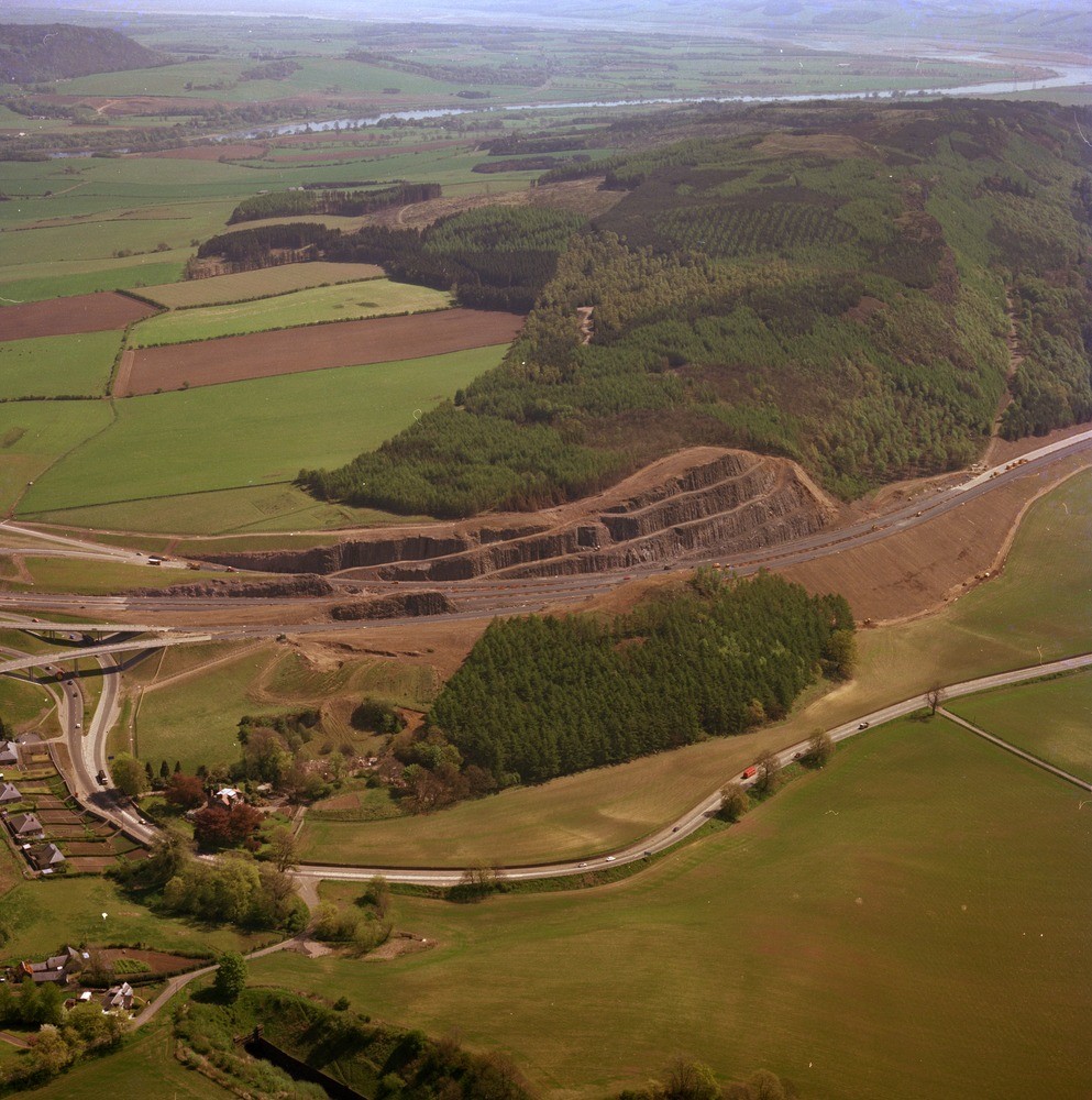
| Caption: | Oblique aerial view from above Craigend, looking east towards Moncreiffe Hill showing a 50 m. high road-cutting (M90) in Lower Devonian lavas. The Tay Valley can be seen in the distance. |
| Description: | Oblique aerial view from above Craigend, looking east towards Moncreiffe Hill showing a 50 m. high road-cutting (M90) in Lower Devonian lavas. The Tay Valley can be seen in the distance. The south (right) side of Moncreiffe Hill is a major fault scarp with Upper Devonian sandstones occupying the lower ground of the Earn Valley. Note the stepped nature of the cutting, an aid to slope stability. The motorway is still under construction in the photograph. |
| Date taken: | Sat Jan 01 00:00:00 GMT 1977 |
| Photographer: | Christie, A. |
| Copyright statement: | NERC |
| Acknowledgment: | This image was digitized with grant-in-aid from SCRAN the Scottish Cultural Resources Access Network |
| X longitude/easting: | 311500 |
| Y latitude/northing: | 720000 |
| Coordinate reference system, ESPG code: | 27700 (OSGB 1936 / British National Grid) |
| Orientation: | Portrait |
| Size: | 301.75 KB; 993 x 1000 pixels; 84 x 85 mm (print at 300 DPI); 263 x 265 mm (screen at 96 DPI); |
| Average Rating: | Not yet rated |
| Categories: | Unsorted Images |
Loading...
Loading...
Reviews
There is currently no feedback