| P number: | P000878 |
|---|---|
| Old photograph number: | D02518 |
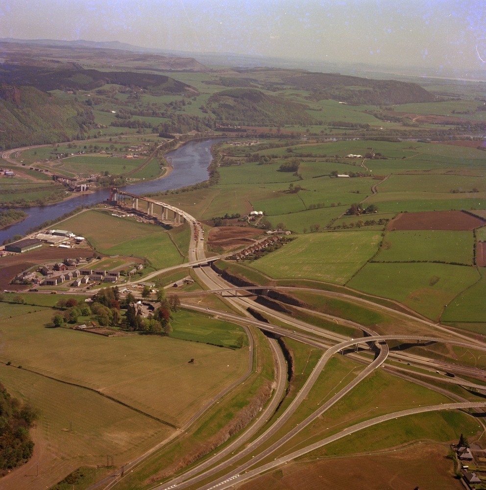
| Caption: | Oblique aerial view from above the Craigend Interchange (M90), looking north-east towards the Tay Valley below Perth. Lower Devonian lavas occur in the road-cuttings in foreground and forming Sidlaw Hills beyond River Tay. |
| Description: | Oblique aerial view from above the Craigend Interchange (M90), looking north-east towards the Tay Valley below Perth. Lower Devonian lavas occur in the road-cuttings in foreground and forming Sidlaw Hills beyond River Tay. Much of the Tay flood plain seen is postglacial inter-tidal clay and silty clays (Carse Clays) or alluvium and post-Carse estuarine deposits. The area north of the river is fill of a buried channel of the River Tay, a late-glacial erosional feature. |
| Date taken: | Sat Jan 01 00:00:00 GMT 1977 |
| Photographer: | Christie, A. |
| Copyright statement: | NERC |
| Acknowledgment: | This image was digitized with grant-in-aid from SCRAN the Scottish Cultural Resources Access Network |
| X longitude/easting: | 311600 |
| Y latitude/northing: | 720400 |
| Coordinate reference system, ESPG code: | 27700 (OSGB 1936 / British National Grid) |
| Orientation: | Portrait |
| Size: | 290.05 KB; 992 x 1000 pixels; 84 x 85 mm (print at 300 DPI); 262 x 265 mm (screen at 96 DPI); |
| Average Rating: | Not yet rated |
| Categories: | Best of BGS Images/ Industrial geology |
Loading...
Loading...
Reviews
There is currently no feedback