| P number: | P000876 |
|---|---|
| Old photograph number: | D02516 |
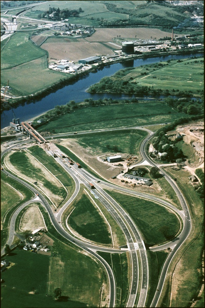
| Caption: | Oblique aerial view of the River Tay below Perth, looking south-west towards the towards the new M85 road bridge works below Friarton Island which can be seen on the right. |
| Description: | Oblique aerial view of the River Tay below Perth, looking south-west towards the towards the new M85 road bridge works below Friarton Island which can be seen on the right. The roadworks are on fill of a buried channel of the River Tay, a late-glacial erosional feature. This channel descends to at least 29 m. below Ordnance Datum. Devonian lavas exposed in road-cuttings and Friarton on ridge beyond river. The buried channel descending to at least 29 m. below O.D. is clear evidence of the late-glacial fall in sea level, almost certainly during the period called the Loch Lomond Stadial. |
| Date taken: | Sat Jan 01 00:00:00 GMT 1977 |
| Photographer: | Christie, A. |
| Copyright statement: | NERC |
| Acknowledgment: | This image was digitized with grant-in-aid from SCRAN the Scottish Cultural Resources Access Network |
| X longitude/easting: | 313500 |
| Y latitude/northing: | 722500 |
| Coordinate reference system, ESPG code: | 27700 (OSGB 1936 / British National Grid) |
| Orientation: | Portrait |
| Size: | 270.06 KB; 667 x 1000 pixels; 56 x 85 mm (print at 300 DPI); 176 x 265 mm (screen at 96 DPI); |
| Average Rating: | Not yet rated |
| Categories: | Unsorted Images |
Loading...
Loading...
Reviews
There is currently no feedback