| P number: | P000874 |
|---|---|
| Old photograph number: | D02501 |
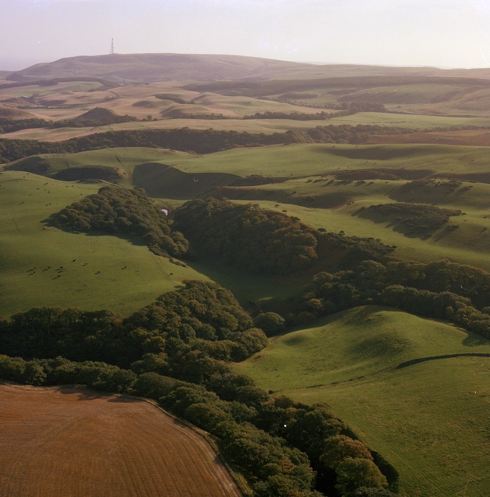
| Caption: | Oblique aerial view from near Halls, 6.5 km. south-south-west of Dunbar, East Lothian. Looking east. A number of linked glacial meltwater channels and moundy sand and gravel deposits. |
| Description: | Oblique aerial view from near Halls, 6.5 km. south-south-west of Dunbar, East Lothian. Looking east. A number of linked glacial meltwater channels and moundy sand and gravel deposits. The moundy sand and gravel deposits are laid down as stratified deposits by glacial meltwater as the ice-sheets melted. They are characterized by rapid variations of grain size and lithological content. During deglaciation as the climate improved, the ice retreated and melted leaving ice-free ground along the slopes of the Lammermuir Hills. Large volumes of glacial meltwater were released to cut numerous glacial meltwater channels. Ice lying in the low ground blocked the river valleys, so damming the meltwaters which were forced to cut new channels along the ice margin and across cols into other valleys. |
| Date taken: | Sat Jan 01 00:00:00 GMT 1977 |
| Photographer: | Christie, A. |
| Copyright statement: | NERC |
| Acknowledgment: | This image was digitized with grant-in-aid from SCRAN the Scottish Cultural Resources Access Network |
| X longitude/easting: | 366450 |
| Y latitude/northing: | 672300 |
| Coordinate reference system, ESPG code: | 27700 (OSGB 1936 / British National Grid) |
| Orientation: | Portrait |
| Size: | 252.45 KB; 986 x 1000 pixels; 83 x 85 mm (print at 300 DPI); 261 x 265 mm (screen at 96 DPI); |
| Average Rating: | Not yet rated |
| Categories: | Unsorted Images |
Loading...
Loading...
Reviews
There is currently no feedback