| P number: | P000873 |
|---|---|
| Old photograph number: | D02500 |
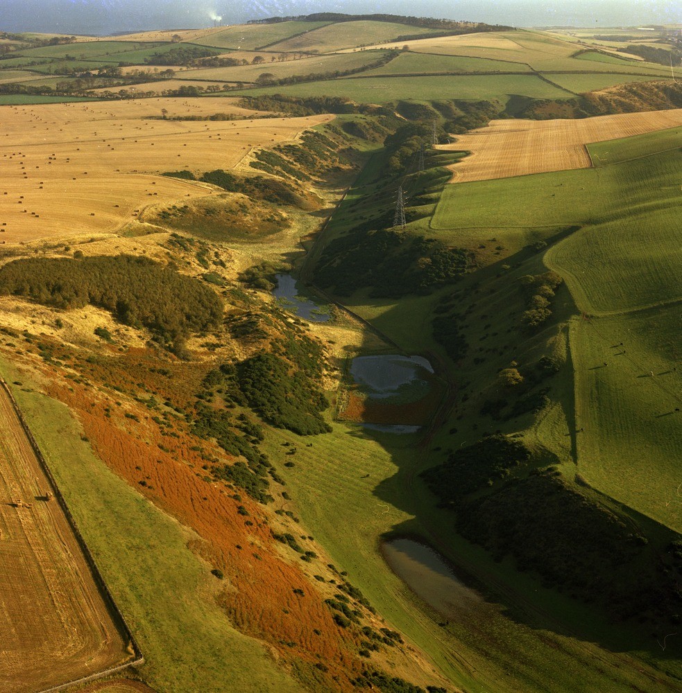
| Caption: | Oblique aerial view of Black Loch, 5.5 km. south-south-west of Dunbar, East Lothian. Looking east-north-east. A glacial meltwater channel. |
| Description: | Oblique aerial view of Black Loch, 5.5 km. south-south-west of Dunbar, East Lothian. Looking east-north-east. A glacial meltwater channel. The meltwater channel now has no flowing water. During deglaciation, as the climate improved and the ice-sheet covering the area began to break up the Southern Upland ice retreated south to form an isolated cap with glaciers in such valleys as the Whiteadder. Ice-free ground appeared along the slopes of the Lammermuir Hills. Large volumes of glacial meltwater were released to cut numerous glacial meltwater channels. |
| Date taken: | Sat Jan 01 00:00:00 GMT 1977 |
| Photographer: | Christie, A. |
| Copyright statement: | NERC |
| Acknowledgment: | This image was digitized with grant-in-aid from SCRAN the Scottish Cultural Resources Access Network |
| X longitude/easting: | 366550 |
| Y latitude/northing: | 673450 |
| Coordinate reference system, ESPG code: | 27700 (OSGB 1936 / British National Grid) |
| Orientation: | Portrait |
| Size: | 345.36 KB; 983 x 1000 pixels; 83 x 85 mm (print at 300 DPI); 260 x 265 mm (screen at 96 DPI); |
| Average Rating: | Not yet rated |
| Categories: | Unsorted Images, Geoscience subjects/ Landforms, glaciation/ Overflow and marginal channels |
Loading...
Loading...
Reviews
There is currently no feedback